535A Dale, TX, USA - Earthquake Result Viewer
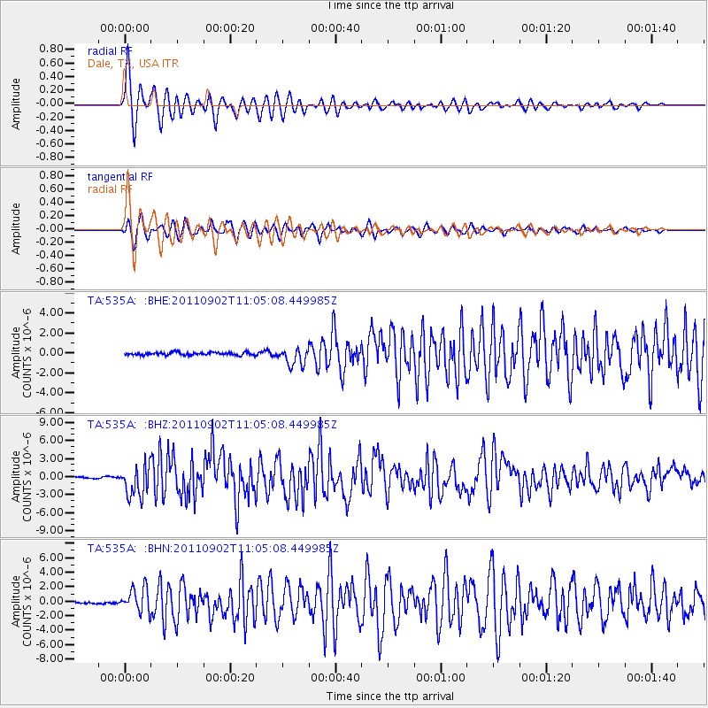
Earthquake location: Fox Islands, Aleutian Islands
Earthquake latitude/longitude: 52.2/-171.7
Earthquake time(UTC): 2011/09/02 (245) 10:55:53 GMT
Earthquake Depth: 32 km
Earthquake Magnitude: 6.5 MB, 6.9 MS, 6.8 MW, 6.8 MW
Earthquake Catalog/Contributor: WHDF/NEIC
Network: TA USArray Transportable Network (new EarthScope stations)
Station: 535A Dale, TX, USA
Lat/Lon: 30.03 N/97.57 W
Elevation: 170 m
Distance: 57.4 deg
Az: 81.821 deg
Baz: 315.336 deg
Ray Param: 0.06343926
Estimated Moho Depth: 17.25 km
Estimated Crust Vp/Vs: 2.03
Assumed Crust Vp: 6.347 km/s
Estimated Crust Vs: 3.134 km/s
Estimated Crust Poisson's Ratio: 0.34
Radial Match: 96.388954 %
Radial Bump: 400
Transverse Match: 92.752 %
Transverse Bump: 400
SOD ConfigId: 414626
Insert Time: 2012-01-18 07:11:03.947 +0000
GWidth: 2.5
Max Bumps: 400
Tol: 0.001

Signal To Noise

ChannelStoNSTALTA
TA:535A: :BHZ:20110902T11:05:08.449985Z23.0714282.622965E-61.1368889E-7
TA:535A: :BHN:20110902T11:05:08.449985Z13.6131271.6887254E-61.2405125E-7
TA:535A: :BHE:20110902T11:05:08.449985Z6.4686329.00025E-71.3913683E-7
Arrivals
Ps2.9 SECOND
PpPs7.9 SECOND
PsPs/PpSs11 SECOND