336A Riesel, TX, USA - Earthquake Result Viewer
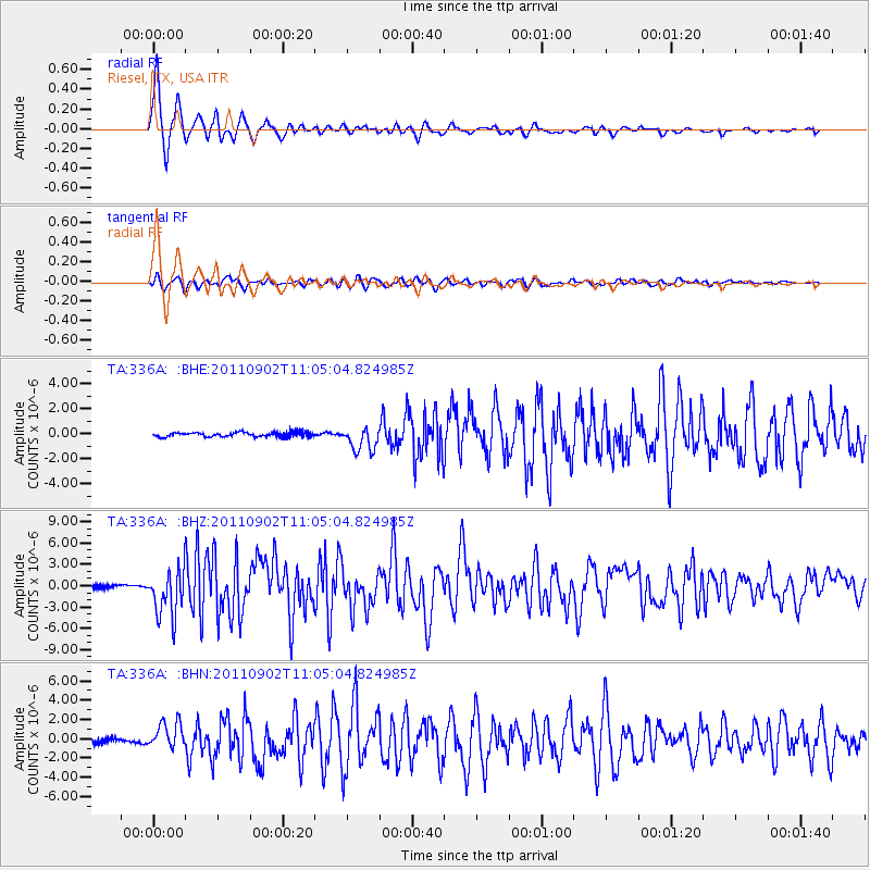
Earthquake location: Fox Islands, Aleutian Islands
Earthquake latitude/longitude: 52.2/-171.7
Earthquake time(UTC): 2011/09/02 (245) 10:55:53 GMT
Earthquake Depth: 32 km
Earthquake Magnitude: 6.5 MB, 6.9 MS, 6.8 MW, 6.8 MW
Earthquake Catalog/Contributor: WHDF/NEIC
Network: TA USArray Transportable Network (new EarthScope stations)
Station: 336A Riesel, TX, USA
Lat/Lon: 31.39 N/96.84 W
Elevation: 140 m
Distance: 56.9 deg
Az: 80.156 deg
Baz: 314.803 deg
Ray Param: 0.06377136
Estimated Moho Depth: 10.75 km
Estimated Crust Vp/Vs: 1.60
Assumed Crust Vp: 6.347 km/s
Estimated Crust Vs: 3.967 km/s
Estimated Crust Poisson's Ratio: 0.18
Radial Match: 97.703064 %
Radial Bump: 323
Transverse Match: 83.9028 %
Transverse Bump: 400
SOD ConfigId: 414626
Insert Time: 2012-01-18 07:12:48.894 +0000
GWidth: 2.5
Max Bumps: 400
Tol: 0.001

Signal To Noise

ChannelStoNSTALTA
TA:336A: :BHZ:20110902T11:05:04.824985Z16.6519723.2913406E-61.9765471E-7
TA:336A: :BHN:20110902T11:05:04.824985Z7.36693951.3671869E-61.8558411E-7
TA:336A: :BHE:20110902T11:05:04.824985Z5.5270759.719228E-71.7584757E-7
Arrivals
Ps1.1 SECOND
PpPs4.2 SECOND
PsPs/PpSs5.2 SECOND