
338A Crockett, TX, USA - Earthquake Result Viewer

| ||||||||||||||||||
| ||||||||||||||||||
| ||||||||||||||||||
|
Signal To Noise
| Channel | StoN | STA | LTA |
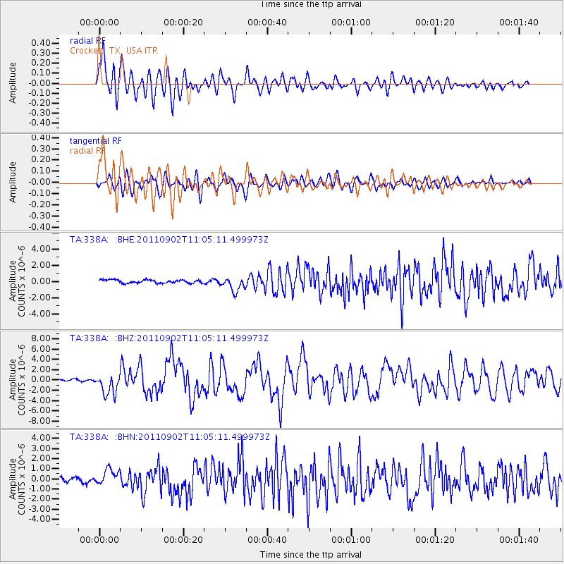
| TA:338A: :BHZ:20110902T11:05:11.499973Z | 9.97411 | 2.0754385E-6 | 2.080826E-7 |
| TA:338A: :BHN:20110902T11:05:11.499973Z | 2.96754 | 7.9444777E-7 | 2.6771255E-7 |
| TA:338A: :BHE:20110902T11:05:11.499973Z | 4.657277 | 9.1129067E-7 | 1.9567025E-7 |
| Arrivals | |
| Ps | 5.2 SECOND |
| PpPs | 14 SECOND |
| PsPs/PpSs | 19 SECOND |

