X37A Clayton, OK, USA - Earthquake Result Viewer
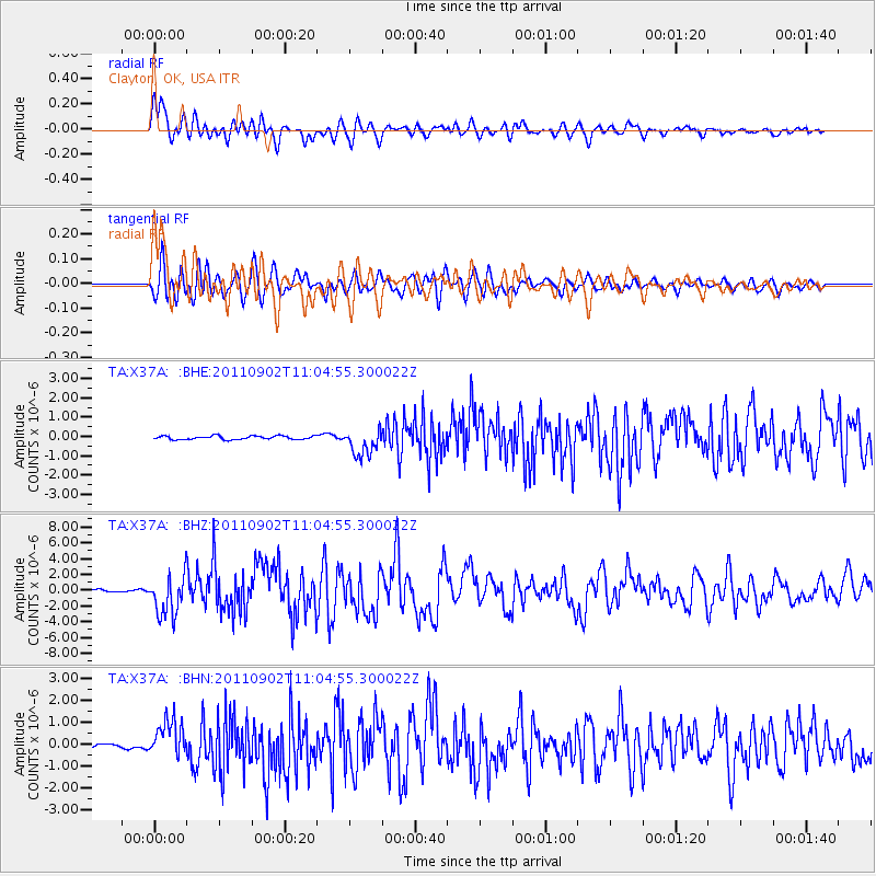
Earthquake location: Fox Islands, Aleutian Islands
Earthquake latitude/longitude: 52.2/-171.7
Earthquake time(UTC): 2011/09/02 (245) 10:55:53 GMT
Earthquake Depth: 32 km
Earthquake Magnitude: 6.5 MB, 6.9 MS, 6.8 MW, 6.8 MW
Earthquake Catalog/Contributor: WHDF/NEIC
Network: TA USArray Transportable Network (new EarthScope stations)
Station: X37A Clayton, OK, USA
Lat/Lon: 34.59 N/95.37 W
Elevation: 207 m
Distance: 55.6 deg
Az: 76.363 deg
Baz: 313.493 deg
Ray Param: 0.06464329
Estimated Moho Depth: 11.75 km
Estimated Crust Vp/Vs: 1.60
Assumed Crust Vp: 6.498 km/s
Estimated Crust Vs: 4.061 km/s
Estimated Crust Poisson's Ratio: 0.18
Radial Match: 88.631226 %
Radial Bump: 400
Transverse Match: 86.73253 %
Transverse Bump: 400
SOD ConfigId: 414626
Insert Time: 2012-01-18 07:15:11.149 +0000
GWidth: 2.5
Max Bumps: 400
Tol: 0.001

Signal To Noise

ChannelStoNSTALTA
TA:X37A: :BHZ:20110902T11:04:55.300022Z21.969682.5705156E-61.1700286E-7
TA:X37A: :BHN:20110902T11:04:55.300022Z10.0961698.1785316E-78.100628E-8
TA:X37A: :BHE:20110902T11:04:55.300022Z7.56706147.0312524E-79.291919E-8
Arrivals
Ps1.2 SECOND
PpPs4.4 SECOND
PsPs/PpSs5.6 SECOND