
W38A Poteau, OK, USA - Earthquake Result Viewer
| ||||||||||||||||||
| ||||||||||||||||||
| ||||||||||||||||||
|
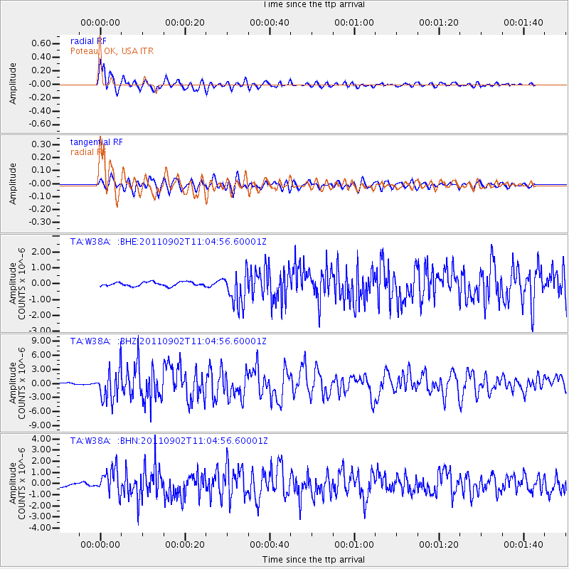
Signal To Noise
| Channel | StoN | STA | LTA |
| TA:W38A: :BHZ:20110902T11:04:56.60001Z | 19.001667 | 3.3973556E-6 | 1.787925E-7 |
| TA:W38A: :BHN:20110902T11:04:56.60001Z | 7.2234306 | 1.1300052E-6 | 1.5643609E-7 |
| TA:W38A: :BHE:20110902T11:04:56.60001Z | 8.484767 | 1.0559321E-6 | 1.2445034E-7 |
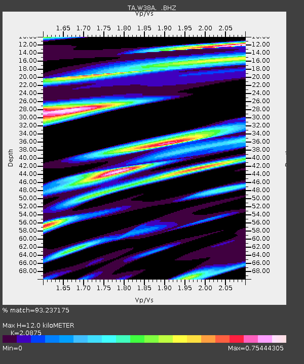
| Arrivals | |
| Ps | 2.1 SECOND |
| PpPs | 5.5 SECOND |
| PsPs/PpSs | 7.6 SECOND |

