Y37A Hugo, OK, USA - Earthquake Result Viewer
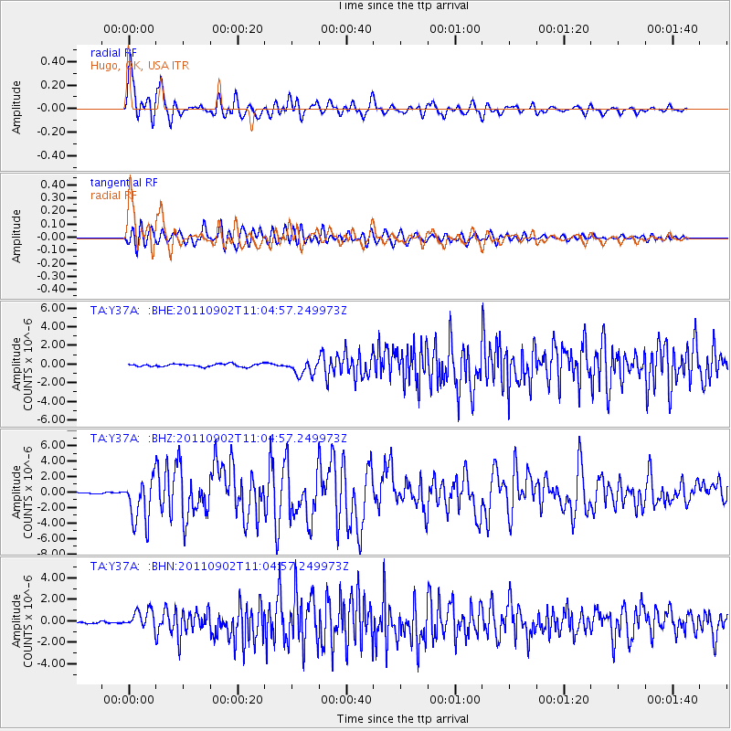
Earthquake location: Fox Islands, Aleutian Islands
Earthquake latitude/longitude: 52.2/-171.7
Earthquake time(UTC): 2011/09/02 (245) 10:55:53 GMT
Earthquake Depth: 32 km
Earthquake Magnitude: 6.5 MB, 6.9 MS, 6.8 MW, 6.8 MW
Earthquake Catalog/Contributor: WHDF/NEIC
Network: TA USArray Transportable Network (new EarthScope stations)
Station: Y37A Hugo, OK, USA
Lat/Lon: 33.98 N/95.62 W
Elevation: 165 m
Distance: 55.9 deg
Az: 77.069 deg
Baz: 313.751 deg
Ray Param: 0.06446743
Estimated Moho Depth: 47.0 km
Estimated Crust Vp/Vs: 1.77
Assumed Crust Vp: 6.245 km/s
Estimated Crust Vs: 3.518 km/s
Estimated Crust Poisson's Ratio: 0.27
Radial Match: 92.56769 %
Radial Bump: 400
Transverse Match: 83.48654 %
Transverse Bump: 400
SOD ConfigId: 414626
Insert Time: 2012-01-18 07:15:44.355 +0000
GWidth: 2.5
Max Bumps: 400
Tol: 0.001

Signal To Noise

ChannelStoNSTALTA
TA:Y37A: :BHZ:20110902T11:04:57.249973Z23.983382.934732E-61.2236525E-7
TA:Y37A: :BHN:20110902T11:04:57.249973Z12.2141498.5800565E-77.024686E-8
TA:Y37A: :BHE:20110902T11:04:57.249973Z5.41604148.046851E-71.485744E-7
Arrivals
Ps6.1 SECOND
PpPs20 SECOND
PsPs/PpSs26 SECOND