N34A Lincoln, NE, USA - Earthquake Result Viewer
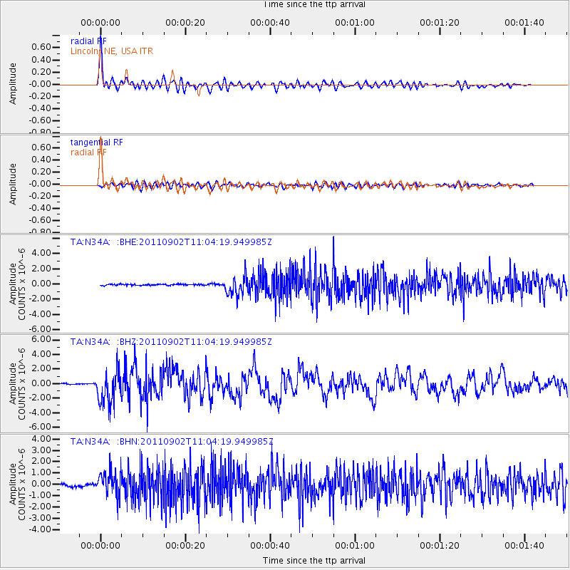
Earthquake location: Fox Islands, Aleutian Islands
Earthquake latitude/longitude: 52.2/-171.7
Earthquake time(UTC): 2011/09/02 (245) 10:55:53 GMT
Earthquake Depth: 32 km
Earthquake Magnitude: 6.5 MB, 6.9 MS, 6.8 MW, 6.8 MW
Earthquake Catalog/Contributor: WHDF/NEIC
Network: TA USArray Transportable Network (new EarthScope stations)
Station: N34A Lincoln, NE, USA
Lat/Lon: 40.84 N/96.50 W
Elevation: 401 m
Distance: 50.8 deg
Az: 71.282 deg
Baz: 309.755 deg
Ray Param: 0.06777723
Estimated Moho Depth: 36.0 km
Estimated Crust Vp/Vs: 1.85
Assumed Crust Vp: 6.498 km/s
Estimated Crust Vs: 3.517 km/s
Estimated Crust Poisson's Ratio: 0.29
Radial Match: 91.710785 %
Radial Bump: 400
Transverse Match: 74.31402 %
Transverse Bump: 400
SOD ConfigId: 414626
Insert Time: 2012-01-18 07:16:28.619 +0000
GWidth: 2.5
Max Bumps: 400
Tol: 0.001

Signal To Noise

ChannelStoNSTALTA
TA:N34A: :BHZ:20110902T11:04:19.949985Z26.6239592.3119874E-68.683861E-8
TA:N34A: :BHN:20110902T11:04:19.949985Z10.642211.079471E-61.0143296E-7
TA:N34A: :BHE:20110902T11:04:19.949985Z17.2304651.2564977E-67.292303E-8
Arrivals
Ps5.0 SECOND
PpPs15 SECOND
PsPs/PpSs20 SECOND