
N35A Tabor, IA, USA - Earthquake Result Viewer
| ||||||||||||||||||
| ||||||||||||||||||
| ||||||||||||||||||
|
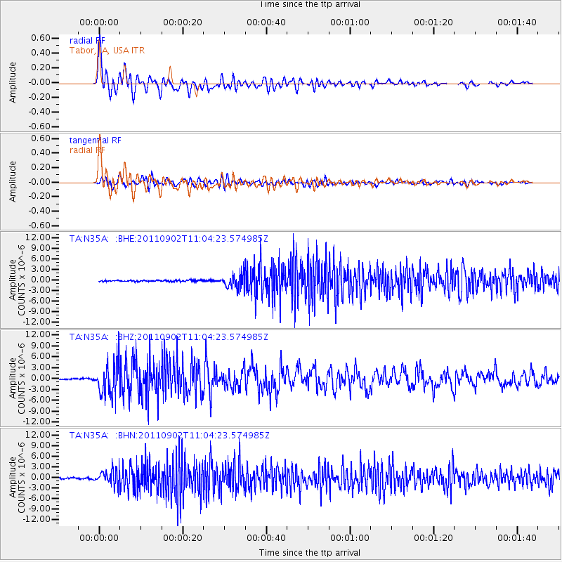
Signal To Noise
| Channel | StoN | STA | LTA |
| TA:N35A: :BHZ:20110902T11:04:23.574985Z | 33.862286 | 4.6154287E-6 | 1.3629997E-7 |
| TA:N35A: :BHN:20110902T11:04:23.574985Z | 14.64079 | 2.129218E-6 | 1.4543053E-7 |
| TA:N35A: :BHE:20110902T11:04:23.574985Z | 13.151849 | 1.9434347E-6 | 1.4776893E-7 |
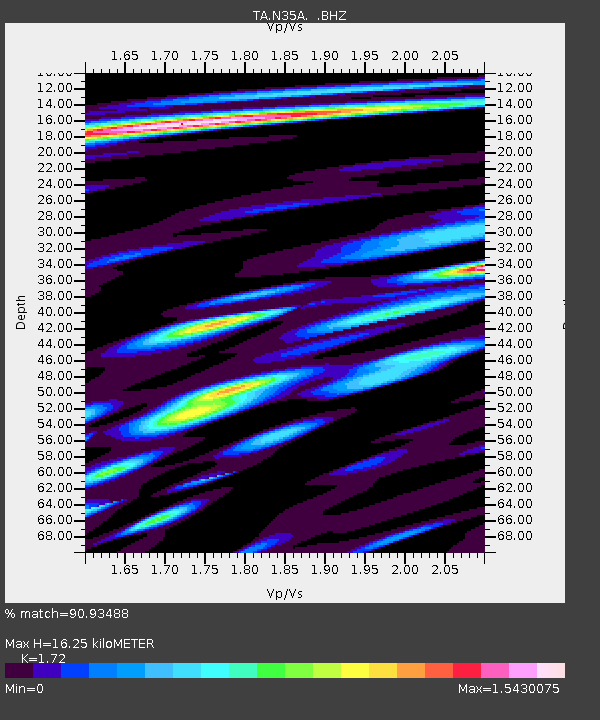
| Arrivals | |
| Ps | 1.9 SECOND |
| PpPs | 6.4 SECOND |
| PsPs/PpSs | 8.3 SECOND |

