O33A Hebron, NE, USA - Earthquake Result Viewer
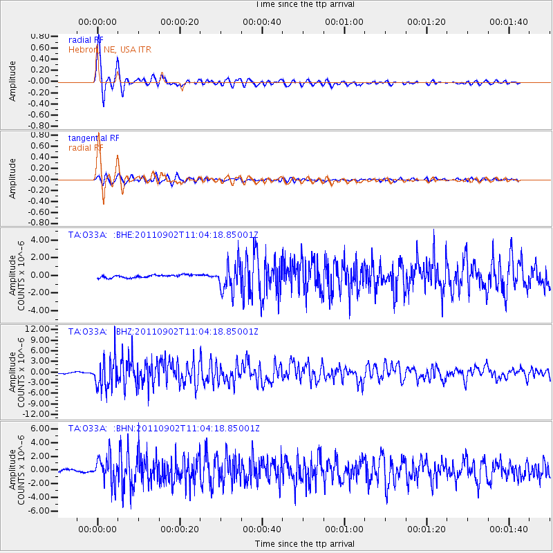
Earthquake location: Fox Islands, Aleutian Islands
Earthquake latitude/longitude: 52.2/-171.7
Earthquake time(UTC): 2011/09/02 (245) 10:55:53 GMT
Earthquake Depth: 32 km
Earthquake Magnitude: 6.5 MB, 6.9 MS, 6.8 MW, 6.8 MW
Earthquake Catalog/Contributor: WHDF/NEIC
Network: TA USArray Transportable Network (new EarthScope stations)
Station: O33A Hebron, NE, USA
Lat/Lon: 40.08 N/97.58 W
Elevation: 480 m
Distance: 50.6 deg
Az: 72.722 deg
Baz: 309.967 deg
Ray Param: 0.06787353
Estimated Moho Depth: 38.75 km
Estimated Crust Vp/Vs: 1.78
Assumed Crust Vp: 6.498 km/s
Estimated Crust Vs: 3.65 km/s
Estimated Crust Poisson's Ratio: 0.27
Radial Match: 97.309044 %
Radial Bump: 391
Transverse Match: 85.57656 %
Transverse Bump: 400
SOD ConfigId: 414626
Insert Time: 2012-01-18 07:17:20.344 +0000
GWidth: 2.5
Max Bumps: 400
Tol: 0.001

Signal To Noise

ChannelStoNSTALTA
TA:O33A: :BHZ:20110902T11:04:18.85001Z26.0301654.3299788E-61.6634466E-7
TA:O33A: :BHN:20110902T11:04:18.85001Z11.7491391.9587499E-61.6671433E-7
TA:O33A: :BHE:20110902T11:04:18.85001Z10.5292311.6218152E-61.5402979E-7
Arrivals
Ps4.9 SECOND
PpPs16 SECOND
PsPs/PpSs21 SECOND