X38A Whitesboro, OK, USA - Earthquake Result Viewer
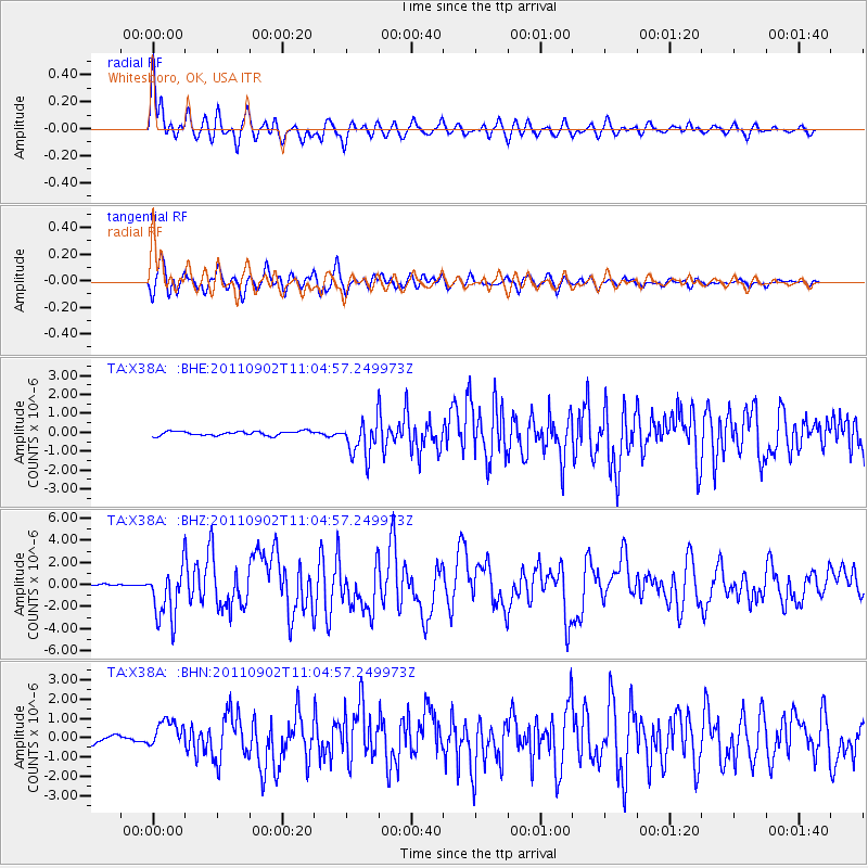
Earthquake location: Fox Islands, Aleutian Islands
Earthquake latitude/longitude: 52.2/-171.7
Earthquake time(UTC): 2011/09/02 (245) 10:55:53 GMT
Earthquake Depth: 32 km
Earthquake Magnitude: 6.5 MB, 6.9 MS, 6.8 MW, 6.8 MW
Earthquake Catalog/Contributor: WHDF/NEIC
Network: TA USArray Transportable Network (new EarthScope stations)
Station: X38A Whitesboro, OK, USA
Lat/Lon: 34.67 N/94.83 W
Elevation: 234 m
Distance: 55.9 deg
Az: 75.92 deg
Baz: 313.551 deg
Ray Param: 0.06446802
Estimated Moho Depth: 33.0 km
Estimated Crust Vp/Vs: 2.03
Assumed Crust Vp: 6.498 km/s
Estimated Crust Vs: 3.197 km/s
Estimated Crust Poisson's Ratio: 0.34
Radial Match: 93.47241 %
Radial Bump: 400
Transverse Match: 87.570175 %
Transverse Bump: 400
SOD ConfigId: 414626
Insert Time: 2012-01-18 07:18:18.750 +0000
GWidth: 2.5
Max Bumps: 400
Tol: 0.001

Signal To Noise

ChannelStoNSTALTA
TA:X38A: :BHZ:20110902T11:04:57.249973Z26.552162.3722193E-68.934186E-8
TA:X38A: :BHN:20110902T11:04:57.249973Z4.37315467.112121E-71.6263137E-7
TA:X38A: :BHE:20110902T11:04:57.249973Z8.6619179.459155E-71.09203945E-7
Arrivals
Ps5.5 SECOND
PpPs15 SECOND
PsPs/PpSs20 SECOND