K33A Hardington, NE, USA - Earthquake Result Viewer
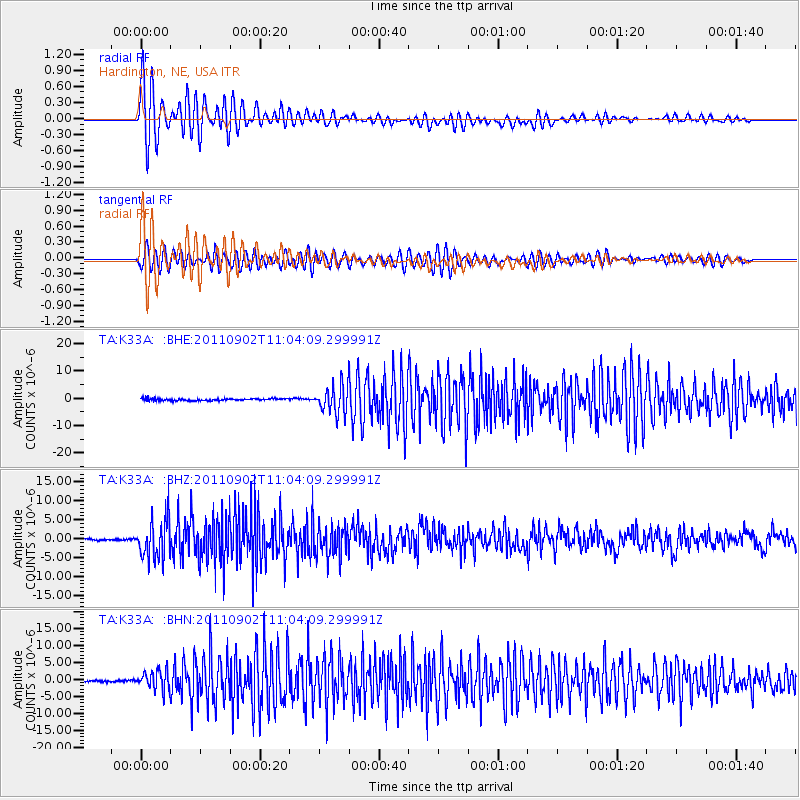
Earthquake location: Fox Islands, Aleutian Islands
Earthquake latitude/longitude: 52.2/-171.7
Earthquake time(UTC): 2011/09/02 (245) 10:55:53 GMT
Earthquake Depth: 32 km
Earthquake Magnitude: 6.5 MB, 6.9 MS, 6.8 MW, 6.8 MW
Earthquake Catalog/Contributor: WHDF/NEIC
Network: TA USArray Transportable Network (new EarthScope stations)
Station: K33A Hardington, NE, USA
Lat/Lon: 42.61 N/97.00 W
Elevation: 507 m
Distance: 49.4 deg
Az: 69.803 deg
Baz: 308.474 deg
Ray Param: 0.06869086
Estimated Moho Depth: 21.25 km
Estimated Crust Vp/Vs: 1.60
Assumed Crust Vp: 6.498 km/s
Estimated Crust Vs: 4.061 km/s
Estimated Crust Poisson's Ratio: 0.18
Radial Match: 94.01531 %
Radial Bump: 400
Transverse Match: 86.5524 %
Transverse Bump: 400
SOD ConfigId: 414626
Insert Time: 2012-01-18 07:19:49.965 +0000
GWidth: 2.5
Max Bumps: 400
Tol: 0.001

Signal To Noise

ChannelStoNSTALTA
TA:K33A: :BHZ:20110902T11:04:09.299991Z20.8460735.016928E-62.4066537E-7
TA:K33A: :BHN:20110902T11:04:09.299991Z9.5079082.8123286E-62.9578837E-7
TA:K33A: :BHE:20110902T11:04:09.299991Z13.5525175.010784E-63.6973088E-7
Arrivals
Ps2.1 SECOND
PpPs8.0 SECOND
PsPs/PpSs10 SECOND