K34A Le Mars, IA, USA - Earthquake Result Viewer
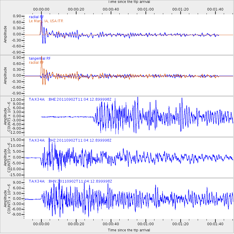
Earthquake location: Fox Islands, Aleutian Islands
Earthquake latitude/longitude: 52.2/-171.7
Earthquake time(UTC): 2011/09/02 (245) 10:55:53 GMT
Earthquake Depth: 32 km
Earthquake Magnitude: 6.5 MB, 6.9 MS, 6.8 MW, 6.8 MW
Earthquake Catalog/Contributor: WHDF/NEIC
Network: TA USArray Transportable Network (new EarthScope stations)
Station: K34A Le Mars, IA, USA
Lat/Lon: 42.69 N/96.10 W
Elevation: 436 m
Distance: 49.8 deg
Az: 69.173 deg
Baz: 308.676 deg
Ray Param: 0.068391345
Estimated Moho Depth: 17.75 km
Estimated Crust Vp/Vs: 1.60
Assumed Crust Vp: 6.498 km/s
Estimated Crust Vs: 4.061 km/s
Estimated Crust Poisson's Ratio: 0.18
Radial Match: 96.01724 %
Radial Bump: 400
Transverse Match: 86.66412 %
Transverse Bump: 400
SOD ConfigId: 414626
Insert Time: 2012-01-18 07:20:31.002 +0000
GWidth: 2.5
Max Bumps: 400
Tol: 0.001

Signal To Noise

ChannelStoNSTALTA
TA:K34A: :BHZ:20110902T11:04:12.899998Z47.199695.2858004E-61.1198802E-7
TA:K34A: :BHN:20110902T11:04:12.899998Z27.3778612.4838823E-69.072594E-8
TA:K34A: :BHE:20110902T11:04:12.899998Z37.8395464.5315987E-61.1975827E-7
Arrivals
Ps1.8 SECOND
PpPs6.6 SECOND
PsPs/PpSs8.4 SECOND