K35A Storm Lake, IA, USA - Earthquake Result Viewer
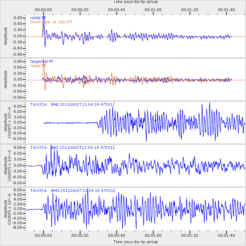
Earthquake location: Fox Islands, Aleutian Islands
Earthquake latitude/longitude: 52.2/-171.7
Earthquake time(UTC): 2011/09/02 (245) 10:55:53 GMT
Earthquake Depth: 32 km
Earthquake Magnitude: 6.5 MB, 6.9 MS, 6.8 MW, 6.8 MW
Earthquake Catalog/Contributor: WHDF/NEIC
Network: TA USArray Transportable Network (new EarthScope stations)
Station: K35A Storm Lake, IA, USA
Lat/Lon: 42.72 N/95.23 W
Elevation: 439 m
Distance: 50.3 deg
Az: 68.617 deg
Baz: 308.903 deg
Ray Param: 0.06808489
Estimated Moho Depth: 69.5 km
Estimated Crust Vp/Vs: 1.90
Assumed Crust Vp: 6.53 km/s
Estimated Crust Vs: 3.428 km/s
Estimated Crust Poisson's Ratio: 0.31
Radial Match: 92.31306 %
Radial Bump: 400
Transverse Match: 88.42513 %
Transverse Bump: 400
SOD ConfigId: 414626
Insert Time: 2012-01-18 07:20:54.002 +0000
GWidth: 2.5
Max Bumps: 400
Tol: 0.001

Signal To Noise

ChannelStoNSTALTA
TA:K35A: :BHZ:20110902T11:04:16.47501Z34.4067423.6928584E-61.0732949E-7
TA:K35A: :BHN:20110902T11:04:16.47501Z23.5882782.4788526E-61.0508833E-7
TA:K35A: :BHE:20110902T11:04:16.47501Z30.728282.7653705E-68.9994316E-8
Arrivals
Ps10 SECOND
PpPs29 SECOND
PsPs/PpSs39 SECOND