I33A Coleman, SD, USA - Earthquake Result Viewer
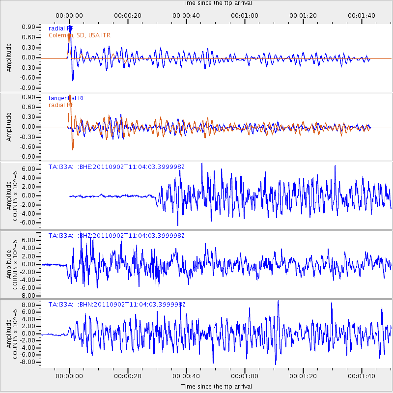
Earthquake location: Fox Islands, Aleutian Islands
Earthquake latitude/longitude: 52.2/-171.7
Earthquake time(UTC): 2011/09/02 (245) 10:55:53 GMT
Earthquake Depth: 32 km
Earthquake Magnitude: 6.5 MB, 6.9 MS, 6.8 MW, 6.8 MW
Earthquake Catalog/Contributor: WHDF/NEIC
Network: TA USArray Transportable Network (new EarthScope stations)
Station: I33A Coleman, SD, USA
Lat/Lon: 44.05 N/96.80 W
Elevation: 509 m
Distance: 48.6 deg
Az: 68.177 deg
Baz: 307.545 deg
Ray Param: 0.069198884
Estimated Moho Depth: 43.0 km
Estimated Crust Vp/Vs: 1.89
Assumed Crust Vp: 6.552 km/s
Estimated Crust Vs: 3.462 km/s
Estimated Crust Poisson's Ratio: 0.31
Radial Match: 86.62848 %
Radial Bump: 400
Transverse Match: 73.928116 %
Transverse Bump: 400
SOD ConfigId: 414626
Insert Time: 2012-01-18 07:21:55.422 +0000
GWidth: 2.5
Max Bumps: 400
Tol: 0.001

Signal To Noise

ChannelStoNSTALTA
TA:I33A: :BHZ:20110902T11:04:03.399998Z23.0142292.7976746E-61.2156282E-7
TA:I33A: :BHN:20110902T11:04:03.399998Z12.1776871.5536302E-61.2758008E-7
TA:I33A: :BHE:20110902T11:04:03.399998Z13.1637021.6698107E-61.2684963E-7
Arrivals
Ps6.2 SECOND
PpPs18 SECOND
PsPs/PpSs24 SECOND