D36A Goodland, MN, USA - Earthquake Result Viewer
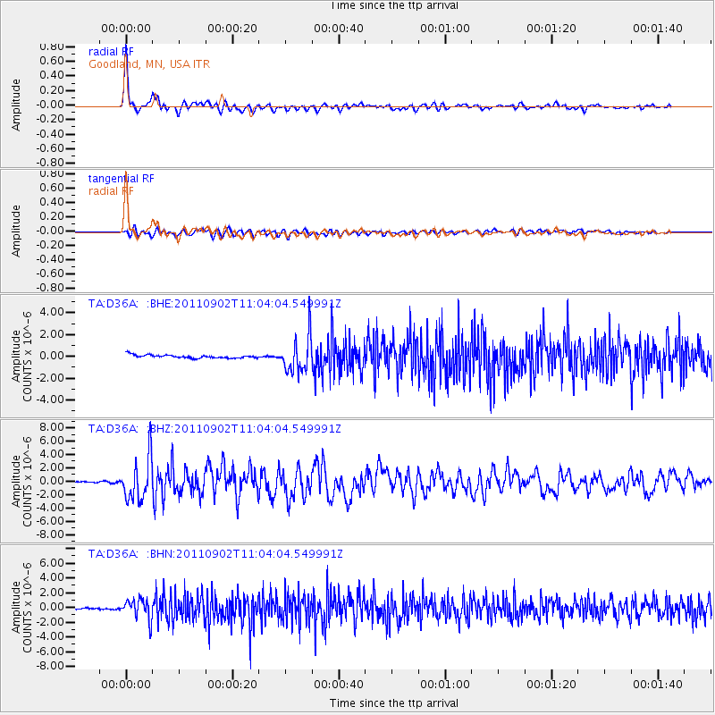
Earthquake location: Fox Islands, Aleutian Islands
Earthquake latitude/longitude: 52.2/-171.7
Earthquake time(UTC): 2011/09/02 (245) 10:55:53 GMT
Earthquake Depth: 32 km
Earthquake Magnitude: 6.5 MB, 6.9 MS, 6.8 MW, 6.8 MW
Earthquake Catalog/Contributor: WHDF/NEIC
Network: TA USArray Transportable Network (new EarthScope stations)
Station: D36A Goodland, MN, USA
Lat/Lon: 47.18 N/93.16 W
Elevation: 434 m
Distance: 48.7 deg
Az: 62.804 deg
Baz: 306.584 deg
Ray Param: 0.06909832
Estimated Moho Depth: 28.75 km
Estimated Crust Vp/Vs: 2.10
Assumed Crust Vp: 6.571 km/s
Estimated Crust Vs: 3.133 km/s
Estimated Crust Poisson's Ratio: 0.35
Radial Match: 94.548805 %
Radial Bump: 400
Transverse Match: 82.18881 %
Transverse Bump: 400
SOD ConfigId: 414626
Insert Time: 2012-01-18 07:25:45.032 +0000
GWidth: 2.5
Max Bumps: 400
Tol: 0.001

Signal To Noise

ChannelStoNSTALTA
TA:D36A: :BHZ:20110902T11:04:04.549991Z31.392023.1786162E-61.0125555E-7
TA:D36A: :BHN:20110902T11:04:04.549991Z14.8514231.3631332E-69.178468E-8
TA:D36A: :BHE:20110902T11:04:04.549991Z11.3908061.6544352E-61.4524304E-7
Arrivals
Ps5.1 SECOND
PpPs13 SECOND
PsPs/PpSs18 SECOND