G31A Conde, SD, USA - Earthquake Result Viewer
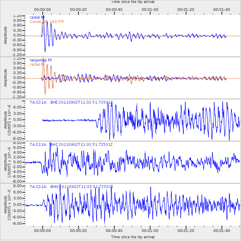
Earthquake location: Fox Islands, Aleutian Islands
Earthquake latitude/longitude: 52.2/-171.7
Earthquake time(UTC): 2011/09/02 (245) 10:55:53 GMT
Earthquake Depth: 32 km
Earthquake Magnitude: 6.5 MB, 6.9 MS, 6.8 MW, 6.8 MW
Earthquake Catalog/Contributor: WHDF/NEIC
Network: TA USArray Transportable Network (new EarthScope stations)
Station: G31A Conde, SD, USA
Lat/Lon: 45.23 N/98.21 W
Elevation: 393 m
Distance: 47.1 deg
Az: 67.721 deg
Baz: 306.252 deg
Ray Param: 0.07016689
Estimated Moho Depth: 15.75 km
Estimated Crust Vp/Vs: 2.07
Assumed Crust Vp: 6.53 km/s
Estimated Crust Vs: 3.159 km/s
Estimated Crust Poisson's Ratio: 0.35
Radial Match: 94.13581 %
Radial Bump: 400
Transverse Match: 86.921524 %
Transverse Bump: 400
SOD ConfigId: 414626
Insert Time: 2012-01-18 07:26:02.773 +0000
GWidth: 2.5
Max Bumps: 400
Tol: 0.001

Signal To Noise

ChannelStoNSTALTA
TA:G31A: :BHZ:20110902T11:03:51.72501Z28.8109993.4398367E-61.1939318E-7
TA:G31A: :BHN:20110902T11:03:51.72501Z16.4163632.2111299E-61.3469061E-7
TA:G31A: :BHE:20110902T11:03:51.72501Z21.5499532.8681739E-61.330942E-7
Arrivals
Ps2.7 SECOND
PpPs7.0 SECOND
PsPs/PpSs9.7 SECOND