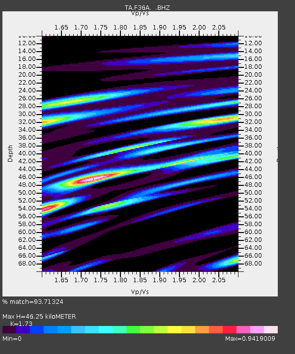
F36A Milaca, MN, USA - Earthquake Result Viewer
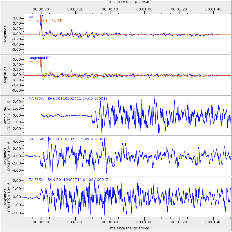
Earthquake location: Fox Islands, Aleutian Islands
Earthquake latitude/longitude: 52.2/-171.7
Earthquake time(UTC): 2011/09/02 (245) 10:55:53 GMT
Earthquake Depth: 32 km
Earthquake Magnitude: 6.5 MB, 6.9 MS, 6.8 MW, 6.8 MW
Earthquake Catalog/Contributor: WHDF/NEIC
Network: TA USArray Transportable Network (new EarthScope stations)
Station: F36A Milaca, MN, USA
Lat/Lon: 45.86 N/93.52 W
Elevation: 345 m
Distance: 49.3 deg
Az: 64.393 deg
Baz: 307.366 deg
Ray Param: 0.06870887
Estimated Moho Depth: 46.25 km
Estimated Crust Vp/Vs: 1.73
Assumed Crust Vp: 6.571 km/s
Estimated Crust Vs: 3.798 km/s
Estimated Crust Poisson's Ratio: 0.25
Radial Match: 93.71324 %
Radial Bump: 363
Transverse Match: 76.91306 %
Transverse Bump: 400
SOD ConfigId: 414626
Insert Time: 2012-01-18 07:26:20.679 +0000
GWidth: 2.5
Max Bumps: 400
Tol: 0.001

Signal To Noise

ChannelStoNSTALTA
TA:F36A: :BHZ:20110902T11:04:09.10001Z15.515312.10971E-61.3597601E-7
TA:F36A: :BHN:20110902T11:04:09.10001Z13.4491927.2544765E-75.3939868E-8
TA:F36A: :BHE:20110902T11:04:09.10001Z11.0344119.592131E-78.6929255E-8
Arrivals
Ps5.5 SECOND
PpPs18 SECOND
PsPs/PpSs24 SECOND