G36A St. Michael, MN, USA - Earthquake Result Viewer
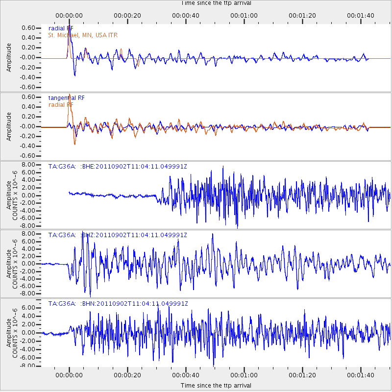
Earthquake location: Fox Islands, Aleutian Islands
Earthquake latitude/longitude: 52.2/-171.7
Earthquake time(UTC): 2011/09/02 (245) 10:55:53 GMT
Earthquake Depth: 32 km
Earthquake Magnitude: 6.5 MB, 6.9 MS, 6.8 MW, 6.8 MW
Earthquake Catalog/Contributor: WHDF/NEIC
Network: TA USArray Transportable Network (new EarthScope stations)
Station: G36A St. Michael, MN, USA
Lat/Lon: 45.23 N/93.75 W
Elevation: 293 m
Distance: 49.6 deg
Az: 65.176 deg
Baz: 307.713 deg
Ray Param: 0.068546325
Estimated Moho Depth: 25.25 km
Estimated Crust Vp/Vs: 1.98
Assumed Crust Vp: 6.571 km/s
Estimated Crust Vs: 3.323 km/s
Estimated Crust Poisson's Ratio: 0.33
Radial Match: 89.26669 %
Radial Bump: 400
Transverse Match: 77.29109 %
Transverse Bump: 400
SOD ConfigId: 414626
Insert Time: 2012-01-18 07:26:33.604 +0000
GWidth: 2.5
Max Bumps: 400
Tol: 0.001

Signal To Noise

ChannelStoNSTALTA
TA:G36A: :BHZ:20110902T11:04:11.049991Z22.5492463.3675701E-61.4934292E-7
TA:G36A: :BHN:20110902T11:04:11.049991Z8.0289991.6969294E-62.1135006E-7
TA:G36A: :BHE:20110902T11:04:11.049991Z5.6373791.8327561E-63.2510783E-7
Arrivals
Ps4.0 SECOND
PpPs11 SECOND
PsPs/PpSs15 SECOND