
G35A Watkins, MN, USA - Earthquake Result Viewer
| ||||||||||||||||||
| ||||||||||||||||||
| ||||||||||||||||||
|
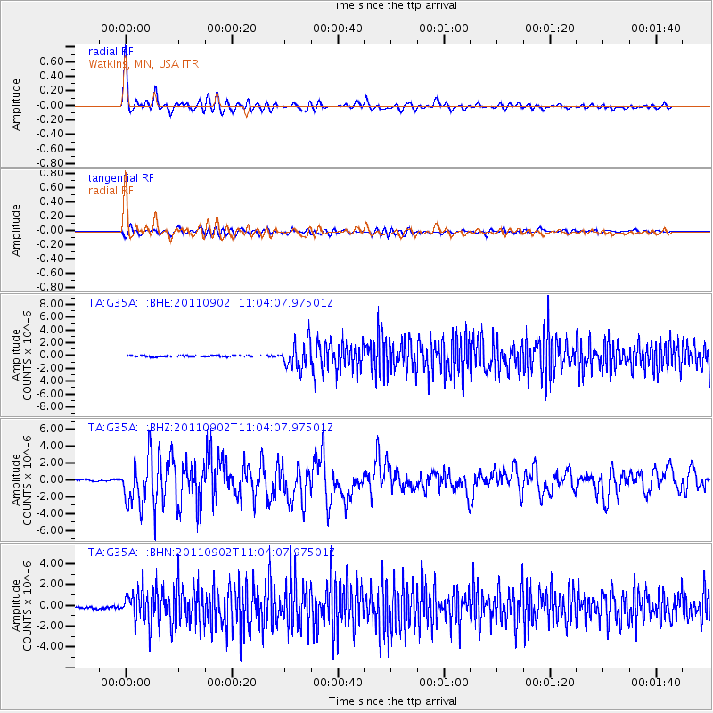
Signal To Noise
| Channel | StoN | STA | LTA |
| TA:G35A: :BHZ:20110902T11:04:07.97501Z | 23.424309 | 2.781396E-6 | 1.1873973E-7 |
| TA:G35A: :BHN:20110902T11:04:07.97501Z | 12.73092 | 1.5199458E-6 | 1.1939011E-7 |
| TA:G35A: :BHE:20110902T11:04:07.97501Z | 21.852411 | 1.9228953E-6 | 8.799465E-8 |
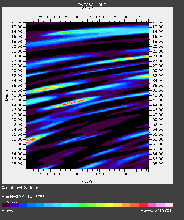
| Arrivals | |
| Ps | 5.8 SECOND |
| PpPs | 22 SECOND |
| PsPs/PpSs | 28 SECOND |

