C37A Embarrass, MN, USA - Earthquake Result Viewer
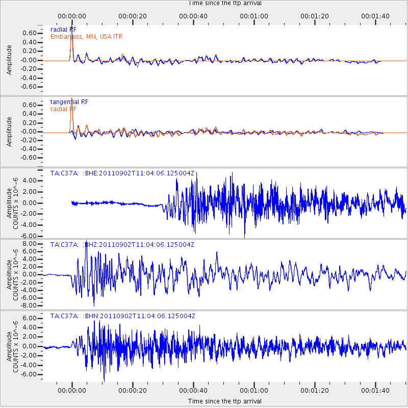
Earthquake location: Fox Islands, Aleutian Islands
Earthquake latitude/longitude: 52.2/-171.7
Earthquake time(UTC): 2011/09/02 (245) 10:55:53 GMT
Earthquake Depth: 32 km
Earthquake Magnitude: 6.5 MB, 6.9 MS, 6.8 MW, 6.8 MW
Earthquake Catalog/Contributor: WHDF/NEIC
Network: TA USArray Transportable Network (new EarthScope stations)
Station: C37A Embarrass, MN, USA
Lat/Lon: 47.73 N/92.19 W
Elevation: 447 m
Distance: 48.9 deg
Az: 61.689 deg
Baz: 306.57 deg
Ray Param: 0.06896155
Estimated Moho Depth: 44.5 km
Estimated Crust Vp/Vs: 1.68
Assumed Crust Vp: 6.571 km/s
Estimated Crust Vs: 3.905 km/s
Estimated Crust Poisson's Ratio: 0.23
Radial Match: 94.29218 %
Radial Bump: 400
Transverse Match: 88.40872 %
Transverse Bump: 400
SOD ConfigId: 414626
Insert Time: 2012-01-18 07:27:21.441 +0000
GWidth: 2.5
Max Bumps: 400
Tol: 0.001

Signal To Noise

ChannelStoNSTALTA
TA:C37A: :BHZ:20110902T11:04:06.125004Z24.3492223.4499387E-61.4168577E-7
TA:C37A: :BHN:20110902T11:04:06.125004Z10.8409491.4092561E-61.299938E-7
TA:C37A: :BHE:20110902T11:04:06.125004Z10.8743131.6195297E-61.4893168E-7
Arrivals
Ps4.9 SECOND
PpPs17 SECOND
PsPs/PpSs22 SECOND