You are here: Home > Network List > TA - USArray Transportable Network (new EarthScope stations) Stations List
> Station T25A Trinidad, CO, USA > Earthquake Result Viewer
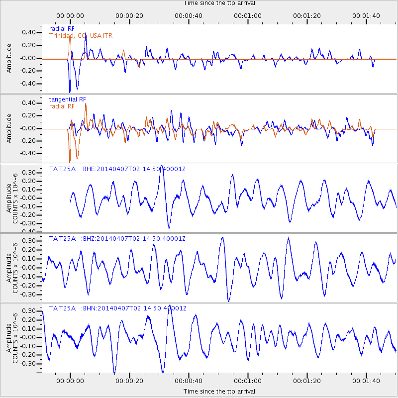
T25A Trinidad, CO, USA - Earthquake Result Viewer
*The percent match for this event was below the threshold and hence no stack was calculated.
| Earthquake location: |
Fiji Islands Region |
| Earthquake latitude/longitude: |
-20.1/-177.4 |
| Earthquake time(UTC): |
2014/04/07 (097) 02:03:10 GMT |
| Earthquake Depth: |
400 km |
| Earthquake Magnitude: |
4.6 mb |
| Earthquake Catalog/Contributor: |
ISC/ISC |
|
| Network: |
TA USArray Transportable Network (new EarthScope stations) |
| Station: |
T25A Trinidad, CO, USA |
| Lat/Lon: |
37.14 N/104.41 W |
| Elevation: |
2017 m |
|
| Distance: |
89.2 deg |
| Az: |
49.853 deg |
| Baz: |
244.036 deg |
| Ray Param: |
$rayparam |
*The percent match for this event was below the threshold and hence was not used in the summary stack. |
|
| Radial Match: |
63.403934 % |
| Radial Bump: |
400 |
| Transverse Match: |
26.169762 % |
| Transverse Bump: |
400 |
| SOD ConfigId: |
3390531 |
| Insert Time: |
2019-04-11 04:44:40.524 +0000 |
| GWidth: |
2.5 |
| Max Bumps: |
400 |
| Tol: |
0.001 |
|
Signal To Noise
| Channel | StoN | STA | LTA |
| TA:T25A: :BHZ:20140407T02:14:50.40001Z | 0.64660716 | 9.179648E-8 | 1.4196638E-7 |
| TA:T25A: :BHN:20140407T02:14:50.40001Z | 0.3846189 | 5.1099533E-8 | 1.3285756E-7 |
| TA:T25A: :BHE:20140407T02:14:50.40001Z | 2.1704648 | 2.404541E-7 | 1.1078461E-7 |
| Arrivals |
| Ps | |
| PpPs | |
| PsPs/PpSs | |


