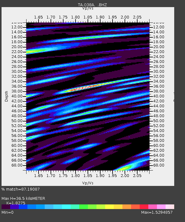
O38A Galt, MO, USA - Earthquake Result Viewer

Earthquake location: Fox Islands, Aleutian Islands
Earthquake latitude/longitude: 52.2/-171.7
Earthquake time(UTC): 2011/09/02 (245) 10:55:53 GMT
Earthquake Depth: 32 km
Earthquake Magnitude: 6.5 MB, 6.9 MS, 6.8 MW, 6.8 MW
Earthquake Catalog/Contributor: WHDF/NEIC
Network: TA USArray Transportable Network (new EarthScope stations)
Station: O38A Galt, MO, USA
Lat/Lon: 40.12 N/93.47 W
Elevation: 266 m
Distance: 53.0 deg
Az: 70.074 deg
Baz: 310.967 deg
Ray Param: 0.06634206
Estimated Moho Depth: 36.5 km
Estimated Crust Vp/Vs: 1.83
Assumed Crust Vp: 6.498 km/s
Estimated Crust Vs: 3.555 km/s
Estimated Crust Poisson's Ratio: 0.29
Radial Match: 87.19087 %
Radial Bump: 400
Transverse Match: 68.8297 %
Transverse Bump: 400
SOD ConfigId: 414626
Insert Time: 2012-01-18 07:31:41.695 +0000
GWidth: 2.5
Max Bumps: 400
Tol: 0.001

Signal To Noise

ChannelStoNSTALTA
TA:O38A: :BHZ:20110902T11:04:36.47501Z31.282734.738066E-61.5145947E-7
TA:O38A: :BHN:20110902T11:04:36.47501Z25.8451442.5336503E-69.803197E-8
TA:O38A: :BHE:20110902T11:04:36.47501Z29.5632844.1180933E-61.3929755E-7
Arrivals
Ps4.9 SECOND
PpPs15 SECOND
PsPs/PpSs20 SECOND