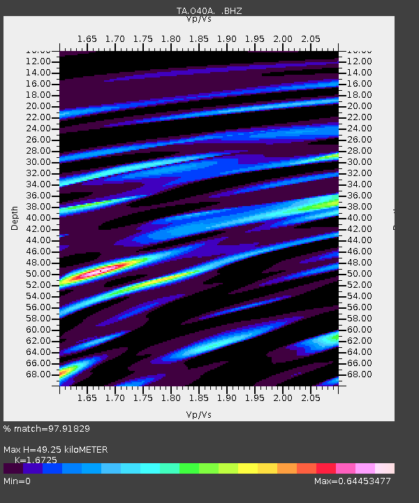
O40A La Belle, MO, USA - Earthquake Result Viewer
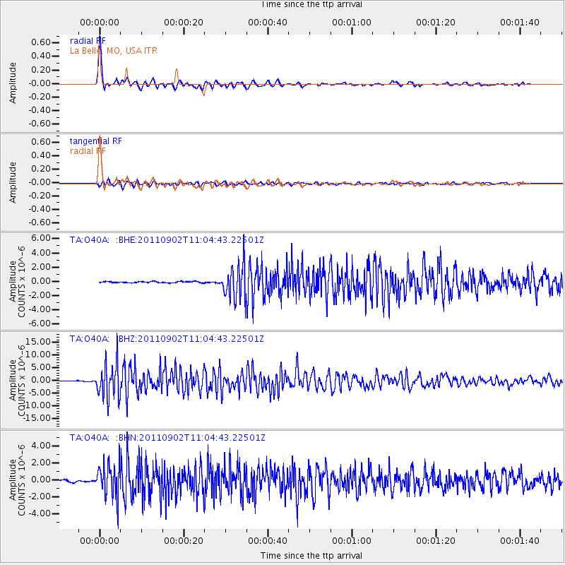
Earthquake location: Fox Islands, Aleutian Islands
Earthquake latitude/longitude: 52.2/-171.7
Earthquake time(UTC): 2011/09/02 (245) 10:55:53 GMT
Earthquake Depth: 32 km
Earthquake Magnitude: 6.5 MB, 6.9 MS, 6.8 MW, 6.8 MW
Earthquake Catalog/Contributor: WHDF/NEIC
Network: TA USArray Transportable Network (new EarthScope stations)
Station: O40A La Belle, MO, USA
Lat/Lon: 40.12 N/91.87 W
Elevation: 206 m
Distance: 53.9 deg
Az: 69.069 deg
Baz: 311.395 deg
Ray Param: 0.06572377
Estimated Moho Depth: 49.25 km
Estimated Crust Vp/Vs: 1.67
Assumed Crust Vp: 6.498 km/s
Estimated Crust Vs: 3.885 km/s
Estimated Crust Poisson's Ratio: 0.22
Radial Match: 97.91829 %
Radial Bump: 329
Transverse Match: 90.78576 %
Transverse Bump: 400
SOD ConfigId: 414626
Insert Time: 2012-01-18 07:33:12.690 +0000
GWidth: 2.5
Max Bumps: 400
Tol: 0.001

Signal To Noise

ChannelStoNSTALTA
TA:O40A: :BHZ:20110902T11:04:43.22501Z83.216126.7100073E-68.0633505E-8
TA:O40A: :BHN:20110902T11:04:43.22501Z19.561851.9405543E-69.920097E-8
TA:O40A: :BHE:20110902T11:04:43.22501Z27.7305762.4415274E-68.8044594E-8
Arrivals
Ps5.4 SECOND
PpPs19 SECOND
PsPs/PpSs25 SECOND