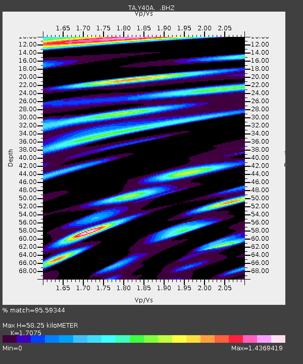
Y40A Okolona, AR, USA - Earthquake Result Viewer
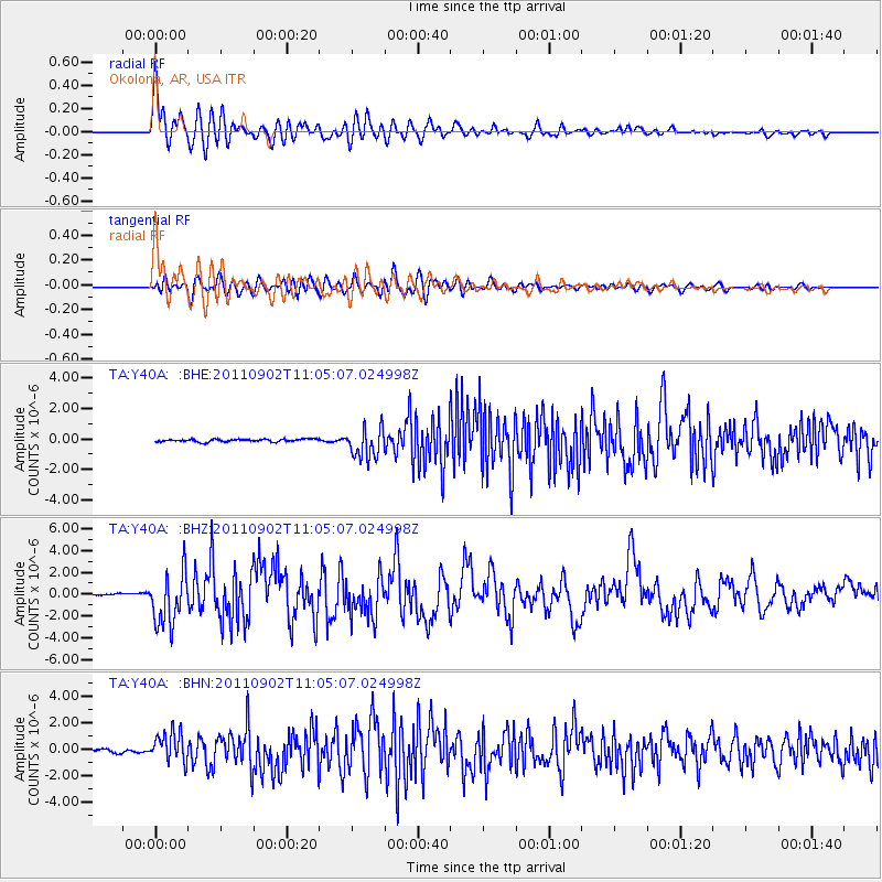
Earthquake location: Fox Islands, Aleutian Islands
Earthquake latitude/longitude: 52.2/-171.7
Earthquake time(UTC): 2011/09/02 (245) 10:55:53 GMT
Earthquake Depth: 32 km
Earthquake Magnitude: 6.5 MB, 6.9 MS, 6.8 MW, 6.8 MW
Earthquake Catalog/Contributor: WHDF/NEIC
Network: TA USArray Transportable Network (new EarthScope stations)
Station: Y40A Okolona, AR, USA
Lat/Lon: 34.01 N/93.28 W
Elevation: 117 m
Distance: 57.2 deg
Az: 75.422 deg
Baz: 314.146 deg
Ray Param: 0.06356963
Estimated Moho Depth: 58.25 km
Estimated Crust Vp/Vs: 1.71
Assumed Crust Vp: 6.498 km/s
Estimated Crust Vs: 3.805 km/s
Estimated Crust Poisson's Ratio: 0.24
Radial Match: 95.59344 %
Radial Bump: 400
Transverse Match: 84.04922 %
Transverse Bump: 400
SOD ConfigId: 414626
Insert Time: 2012-01-18 07:34:05.065 +0000
GWidth: 2.5
Max Bumps: 400
Tol: 0.001

Signal To Noise

ChannelStoNSTALTA
TA:Y40A: :BHZ:20110902T11:05:07.024998Z25.640822.3944715E-69.338514E-8
TA:Y40A: :BHN:20110902T11:05:07.024998Z7.87315031.1034145E-61.4014906E-7
TA:Y40A: :BHE:20110902T11:05:07.024998Z11.1303659.890797E-78.886319E-8
Arrivals
Ps6.7 SECOND
PpPs23 SECOND
PsPs/PpSs30 SECOND