T38A Diamond, MO, USA - Earthquake Result Viewer
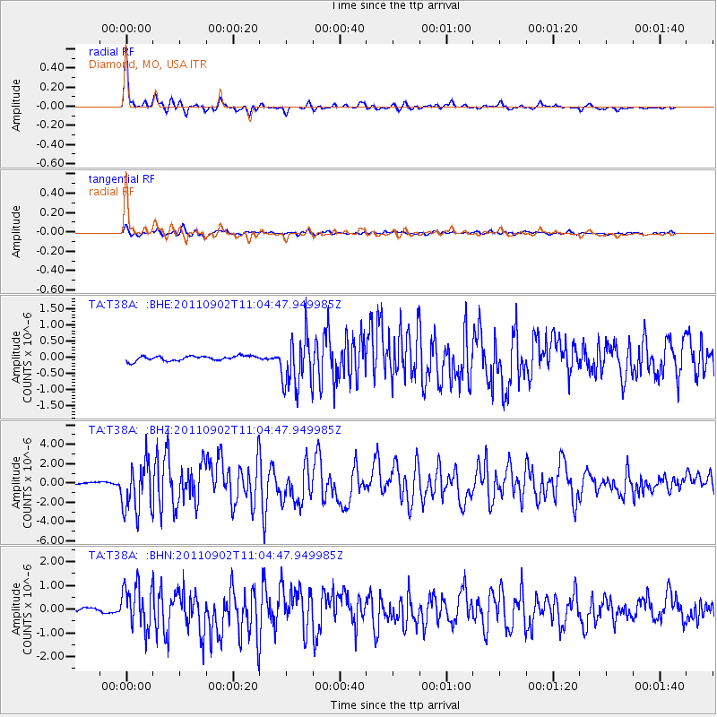
Earthquake location: Fox Islands, Aleutian Islands
Earthquake latitude/longitude: 52.2/-171.7
Earthquake time(UTC): 2011/09/02 (245) 10:55:53 GMT
Earthquake Depth: 32 km
Earthquake Magnitude: 6.5 MB, 6.9 MS, 6.8 MW, 6.8 MW
Earthquake Catalog/Contributor: WHDF/NEIC
Network: TA USArray Transportable Network (new EarthScope stations)
Station: T38A Diamond, MO, USA
Lat/Lon: 37.04 N/94.29 W
Elevation: 349 m
Distance: 54.6 deg
Az: 73.456 deg
Baz: 312.457 deg
Ray Param: 0.06531785
Estimated Moho Depth: 44.25 km
Estimated Crust Vp/Vs: 1.76
Assumed Crust Vp: 6.53 km/s
Estimated Crust Vs: 3.716 km/s
Estimated Crust Poisson's Ratio: 0.26
Radial Match: 96.175095 %
Radial Bump: 322
Transverse Match: 85.194786 %
Transverse Bump: 400
SOD ConfigId: 414626
Insert Time: 2012-01-18 07:34:21.183 +0000
GWidth: 2.5
Max Bumps: 400
Tol: 0.001

Signal To Noise

ChannelStoNSTALTA
TA:T38A: :BHZ:20110902T11:04:47.949985Z26.7847842.569679E-69.593801E-8
TA:T38A: :BHN:20110902T11:04:47.949985Z10.5901799.064525E-78.559368E-8
TA:T38A: :BHE:20110902T11:04:47.949985Z11.1670248.136944E-77.2865824E-8
Arrivals
Ps5.4 SECOND
PpPs18 SECOND
PsPs/PpSs23 SECOND