U39A Green Forest, AR, USA - Earthquake Result Viewer
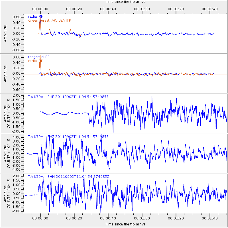
Earthquake location: Fox Islands, Aleutian Islands
Earthquake latitude/longitude: 52.2/-171.7
Earthquake time(UTC): 2011/09/02 (245) 10:55:53 GMT
Earthquake Depth: 32 km
Earthquake Magnitude: 6.5 MB, 6.9 MS, 6.8 MW, 6.8 MW
Earthquake Catalog/Contributor: WHDF/NEIC
Network: TA USArray Transportable Network (new EarthScope stations)
Station: U39A Green Forest, AR, USA
Lat/Lon: 36.38 N/93.48 W
Elevation: 433 m
Distance: 55.5 deg
Az: 73.5 deg
Baz: 312.966 deg
Ray Param: 0.064708985
Estimated Moho Depth: 46.0 km
Estimated Crust Vp/Vs: 1.74
Assumed Crust Vp: 6.53 km/s
Estimated Crust Vs: 3.753 km/s
Estimated Crust Poisson's Ratio: 0.25
Radial Match: 94.7688 %
Radial Bump: 400
Transverse Match: 77.514656 %
Transverse Bump: 400
SOD ConfigId: 414626
Insert Time: 2012-01-18 07:34:36.807 +0000
GWidth: 2.5
Max Bumps: 400
Tol: 0.001

Signal To Noise

ChannelStoNSTALTA
TA:U39A: :BHZ:20110902T11:04:54.574985Z17.9546852.1404387E-61.1921338E-7
TA:U39A: :BHN:20110902T11:04:54.574985Z13.2546088.7378027E-76.5922755E-8
TA:U39A: :BHE:20110902T11:04:54.574985Z8.3676638.312574E-79.9341634E-8
Arrivals
Ps5.5 SECOND
PpPs18 SECOND
PsPs/PpSs24 SECOND