146A Union, MS, USA - Earthquake Result Viewer
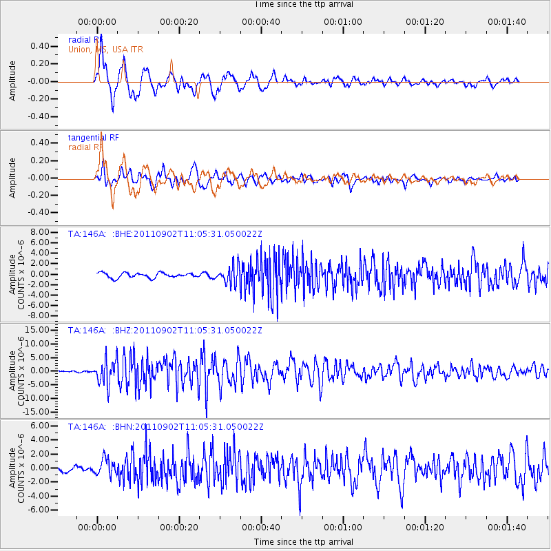
Earthquake location: Fox Islands, Aleutian Islands
Earthquake latitude/longitude: 52.2/-171.7
Earthquake time(UTC): 2011/09/02 (245) 10:55:53 GMT
Earthquake Depth: 32 km
Earthquake Magnitude: 6.5 MB, 6.9 MS, 6.8 MW, 6.8 MW
Earthquake Catalog/Contributor: WHDF/NEIC
Network: TA USArray Transportable Network (new EarthScope stations)
Station: 146A Union, MS, USA
Lat/Lon: 32.64 N/89.06 W
Elevation: 164 m
Distance: 60.7 deg
Az: 73.647 deg
Baz: 315.541 deg
Ray Param: 0.061303437
Estimated Moho Depth: 15.25 km
Estimated Crust Vp/Vs: 1.77
Assumed Crust Vp: 6.201 km/s
Estimated Crust Vs: 3.494 km/s
Estimated Crust Poisson's Ratio: 0.27
Radial Match: 90.908165 %
Radial Bump: 400
Transverse Match: 84.40476 %
Transverse Bump: 400
SOD ConfigId: 414626
Insert Time: 2012-01-18 07:38:24.766 +0000
GWidth: 2.5
Max Bumps: 400
Tol: 0.001

Signal To Noise

ChannelStoNSTALTA
TA:146A: :BHZ:20110902T11:05:31.050022Z25.609924.4876465E-61.7523078E-7
TA:146A: :BHN:20110902T11:05:31.050022Z3.1343881.1794743E-63.7630133E-7
TA:146A: :BHE:20110902T11:05:31.050022Z3.78060441.748631E-64.6252686E-7
Arrivals
Ps2.0 SECOND
PpPs6.5 SECOND
PsPs/PpSs8.5 SECOND