
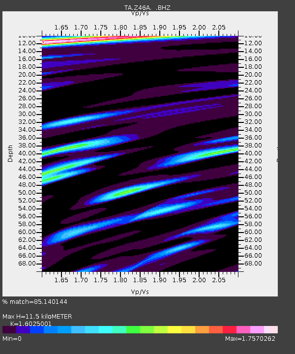
Z46A Louisville, MS, USA - Earthquake Result Viewer
| ||||||||||||||||||
| ||||||||||||||||||
| ||||||||||||||||||
|
Signal To Noise
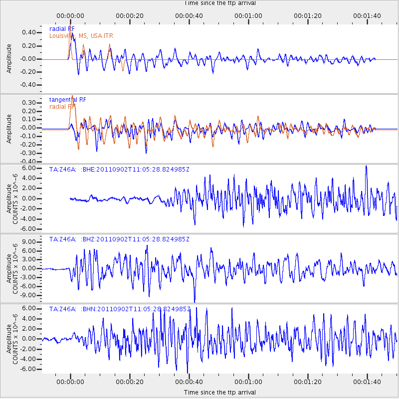
| Channel | StoN | STA | LTA |
| TA:Z46A: :BHZ:20110902T11:05:28.824985Z | 18.017448 | 3.1026334E-6 | 1.722016E-7 |
| TA:Z46A: :BHN:20110902T11:05:28.824985Z | 3.1924105 | 6.299959E-7 | 1.9734178E-7 |
| TA:Z46A: :BHE:20110902T11:05:28.824985Z | 2.5984087 | 7.3094714E-7 | 2.813057E-7 |
| Arrivals | |
| Ps | 1.2 SECOND |
| PpPs | 4.6 SECOND |
| PsPs/PpSs | 5.8 SECOND |

