Y41A Eaglette Bearden, AR, USA - Earthquake Result Viewer
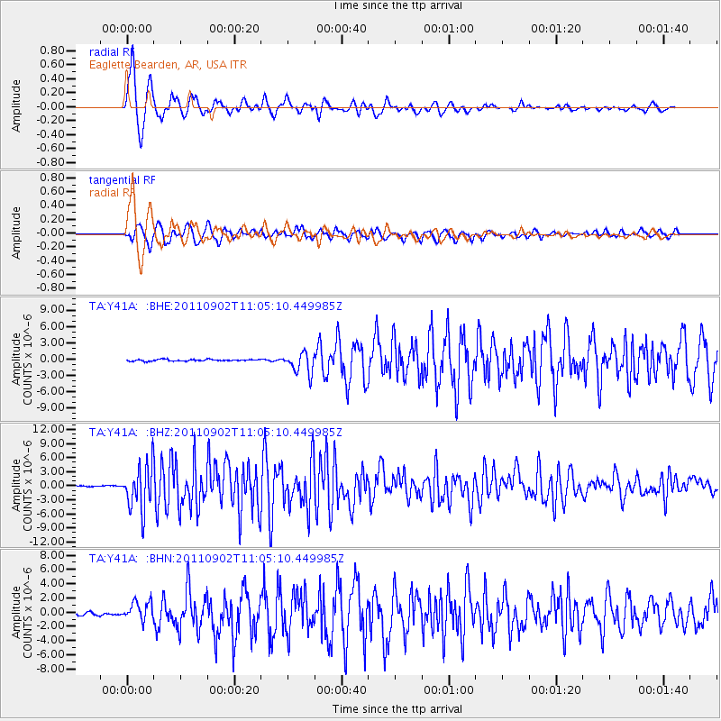
Earthquake location: Fox Islands, Aleutian Islands
Earthquake latitude/longitude: 52.2/-171.7
Earthquake time(UTC): 2011/09/02 (245) 10:55:53 GMT
Earthquake Depth: 32 km
Earthquake Magnitude: 6.5 MB, 6.9 MS, 6.8 MW, 6.8 MW
Earthquake Catalog/Contributor: WHDF/NEIC
Network: TA USArray Transportable Network (new EarthScope stations)
Station: Y41A Eaglette Bearden, AR, USA
Lat/Lon: 33.88 N/92.61 W
Elevation: 99 m
Distance: 57.7 deg
Az: 75.074 deg
Baz: 314.33 deg
Ray Param: 0.063257955
Estimated Moho Depth: 11.5 km
Estimated Crust Vp/Vs: 1.60
Assumed Crust Vp: 6.245 km/s
Estimated Crust Vs: 3.903 km/s
Estimated Crust Poisson's Ratio: 0.18
Radial Match: 96.739075 %
Radial Bump: 368
Transverse Match: 92.009636 %
Transverse Bump: 400
SOD ConfigId: 414626
Insert Time: 2012-01-18 07:41:25.956 +0000
GWidth: 2.5
Max Bumps: 400
Tol: 0.001

Signal To Noise

ChannelStoNSTALTA
TA:Y41A: :BHZ:20110902T11:05:10.449985Z48.762344.7992935E-69.842213E-8
TA:Y41A: :BHN:20110902T11:05:10.449985Z6.43467661.3354677E-62.0754231E-7
TA:Y41A: :BHE:20110902T11:05:10.449985Z12.1865571.91178E-61.5687614E-7
Arrivals
Ps1.2 SECOND
PpPs4.5 SECOND
PsPs/PpSs5.7 SECOND