
T41A Mountain View, MO, USA - Earthquake Result Viewer
| ||||||||||||||||||
| ||||||||||||||||||
| ||||||||||||||||||
|
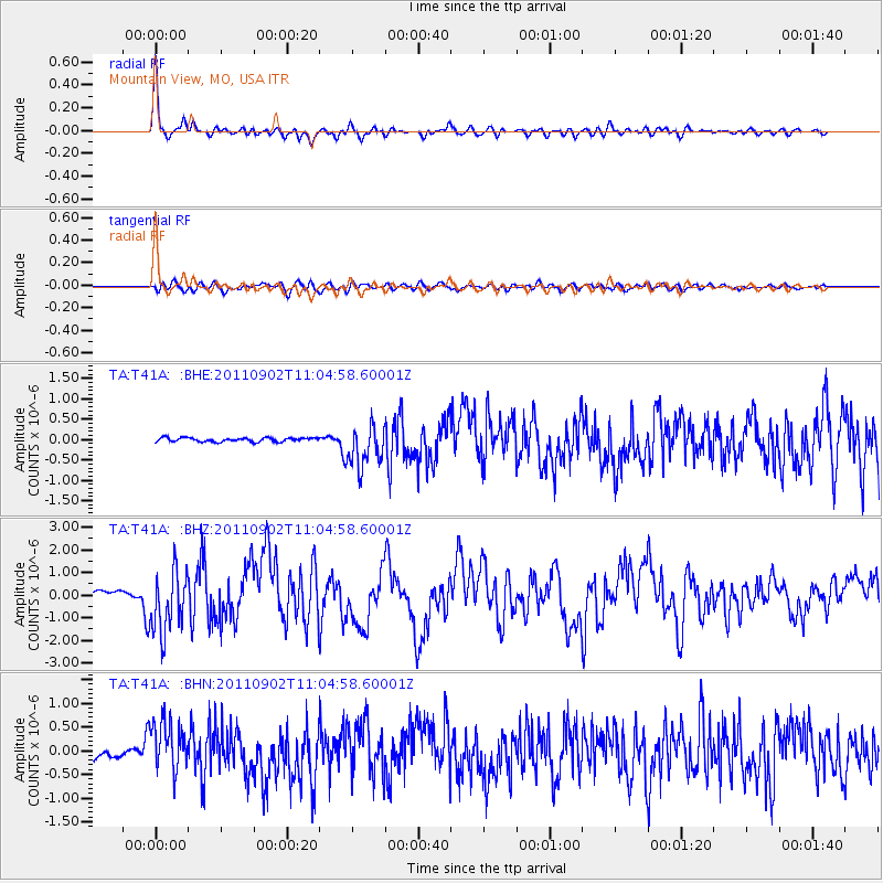
Signal To Noise
| Channel | StoN | STA | LTA |
| TA:T41A: :BHZ:20110902T11:04:58.60001Z | 12.4059305 | 1.3831728E-6 | 1.11492874E-7 |
| TA:T41A: :BHN:20110902T11:04:58.60001Z | 7.381035 | 5.279644E-7 | 7.152986E-8 |
| TA:T41A: :BHE:20110902T11:04:58.60001Z | 11.244661 | 5.2433603E-7 | 4.6629776E-8 |
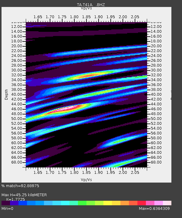
| Arrivals | |
| Ps | 5.6 SECOND |
| PpPs | 18 SECOND |
| PsPs/PpSs | 24 SECOND |

