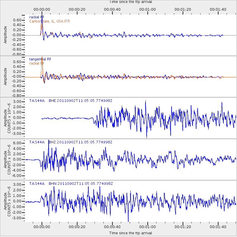
S44A Carbondale, IL, USA - Earthquake Result Viewer
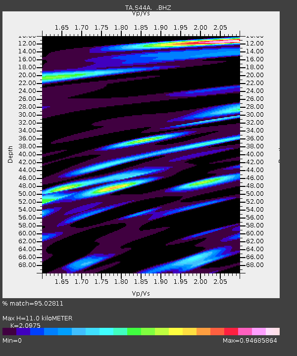
Earthquake location: Fox Islands, Aleutian Islands
Earthquake latitude/longitude: 52.2/-171.7
Earthquake time(UTC): 2011/09/02 (245) 10:55:53 GMT
Earthquake Depth: 32 km
Earthquake Magnitude: 6.5 MB, 6.9 MS, 6.8 MW, 6.8 MW
Earthquake Catalog/Contributor: WHDF/NEIC
Network: TA USArray Transportable Network (new EarthScope stations)
Station: S44A Carbondale, IL, USA
Lat/Lon: 37.69 N/89.26 W
Elevation: 155 m
Distance: 57.1 deg
Az: 69.572 deg
Baz: 313.319 deg
Ray Param: 0.063682206
Estimated Moho Depth: 11.0 km
Estimated Crust Vp/Vs: 2.10
Assumed Crust Vp: 6.444 km/s
Estimated Crust Vs: 3.072 km/s
Estimated Crust Poisson's Ratio: 0.35
Radial Match: 95.02811 %
Radial Bump: 400
Transverse Match: 86.3835 %
Transverse Bump: 400
SOD ConfigId: 414626
Insert Time: 2012-01-18 07:43:18.912 +0000
GWidth: 2.5
Max Bumps: 400
Tol: 0.001

Signal To Noise

ChannelStoNSTALTA
TA:S44A: :BHZ:20110902T11:05:05.774998Z41.3951722.3371986E-65.646066E-8
TA:S44A: :BHN:20110902T11:05:05.774998Z16.0832849.3671326E-75.8241415E-8
TA:S44A: :BHE:20110902T11:05:05.774998Z14.2868979.546098E-76.681716E-8
Arrivals
Ps2.0 SECOND
PpPs5.1 SECOND
PsPs/PpSs7.0 SECOND