J40A Soldiers Grove, WI, USA - Earthquake Result Viewer
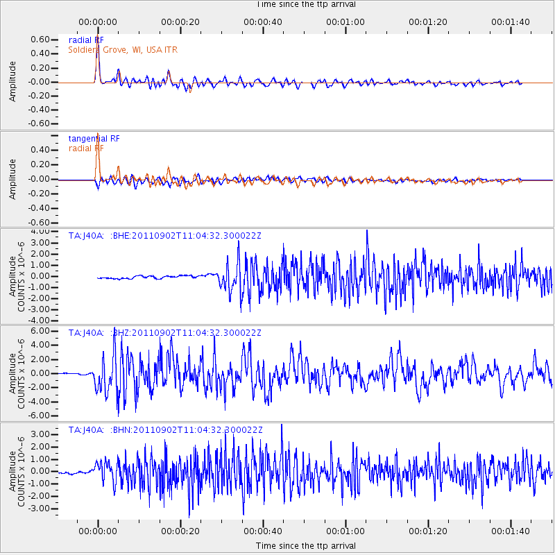
Earthquake location: Fox Islands, Aleutian Islands
Earthquake latitude/longitude: 52.2/-171.7
Earthquake time(UTC): 2011/09/02 (245) 10:55:53 GMT
Earthquake Depth: 32 km
Earthquake Magnitude: 6.5 MB, 6.9 MS, 6.8 MW, 6.8 MW
Earthquake Catalog/Contributor: WHDF/NEIC
Network: TA USArray Transportable Network (new EarthScope stations)
Station: J40A Soldiers Grove, WI, USA
Lat/Lon: 43.40 N/90.74 W
Elevation: 353 m
Distance: 52.4 deg
Az: 65.276 deg
Baz: 309.873 deg
Ray Param: 0.06671183
Estimated Moho Depth: 44.0 km
Estimated Crust Vp/Vs: 1.70
Assumed Crust Vp: 6.53 km/s
Estimated Crust Vs: 3.836 km/s
Estimated Crust Poisson's Ratio: 0.24
Radial Match: 93.690094 %
Radial Bump: 400
Transverse Match: 81.40099 %
Transverse Bump: 400
SOD ConfigId: 414626
Insert Time: 2012-01-18 07:45:01.945 +0000
GWidth: 2.5
Max Bumps: 400
Tol: 0.001

Signal To Noise

ChannelStoNSTALTA
TA:J40A: :BHZ:20110902T11:04:32.300022Z23.6627082.6463597E-61.1183672E-7
TA:J40A: :BHN:20110902T11:04:32.300022Z6.8488698.145564E-71.1893299E-7
TA:J40A: :BHE:20110902T11:04:32.300022Z11.4291231.3189992E-61.15406856E-7
Arrivals
Ps5.0 SECOND
PpPs17 SECOND
PsPs/PpSs22 SECOND