L40A Anamosa, IA, USA - Earthquake Result Viewer
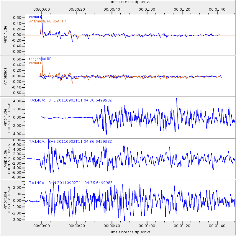
Earthquake location: Fox Islands, Aleutian Islands
Earthquake latitude/longitude: 52.2/-171.7
Earthquake time(UTC): 2011/09/02 (245) 10:55:53 GMT
Earthquake Depth: 32 km
Earthquake Magnitude: 6.5 MB, 6.9 MS, 6.8 MW, 6.8 MW
Earthquake Catalog/Contributor: WHDF/NEIC
Network: TA USArray Transportable Network (new EarthScope stations)
Station: L40A Anamosa, IA, USA
Lat/Lon: 42.06 N/91.22 W
Elevation: 242 m
Distance: 53.0 deg
Az: 66.843 deg
Baz: 310.497 deg
Ray Param: 0.066325925
Estimated Moho Depth: 31.75 km
Estimated Crust Vp/Vs: 1.87
Assumed Crust Vp: 6.53 km/s
Estimated Crust Vs: 3.502 km/s
Estimated Crust Poisson's Ratio: 0.30
Radial Match: 96.10176 %
Radial Bump: 353
Transverse Match: 84.728485 %
Transverse Bump: 400
SOD ConfigId: 414626
Insert Time: 2012-01-18 07:45:28.407 +0000
GWidth: 2.5
Max Bumps: 400
Tol: 0.001

Signal To Noise

ChannelStoNSTALTA
TA:L40A: :BHZ:20110902T11:04:36.649998Z25.8620452.9441956E-61.1384233E-7
TA:L40A: :BHN:20110902T11:04:36.649998Z7.57316979.553751E-71.2615261E-7
TA:L40A: :BHE:20110902T11:04:36.649998Z13.041581.0998461E-68.4333806E-8
Arrivals
Ps4.4 SECOND
PpPs13 SECOND
PsPs/PpSs18 SECOND