U41A Viola, AR, USA - Earthquake Result Viewer
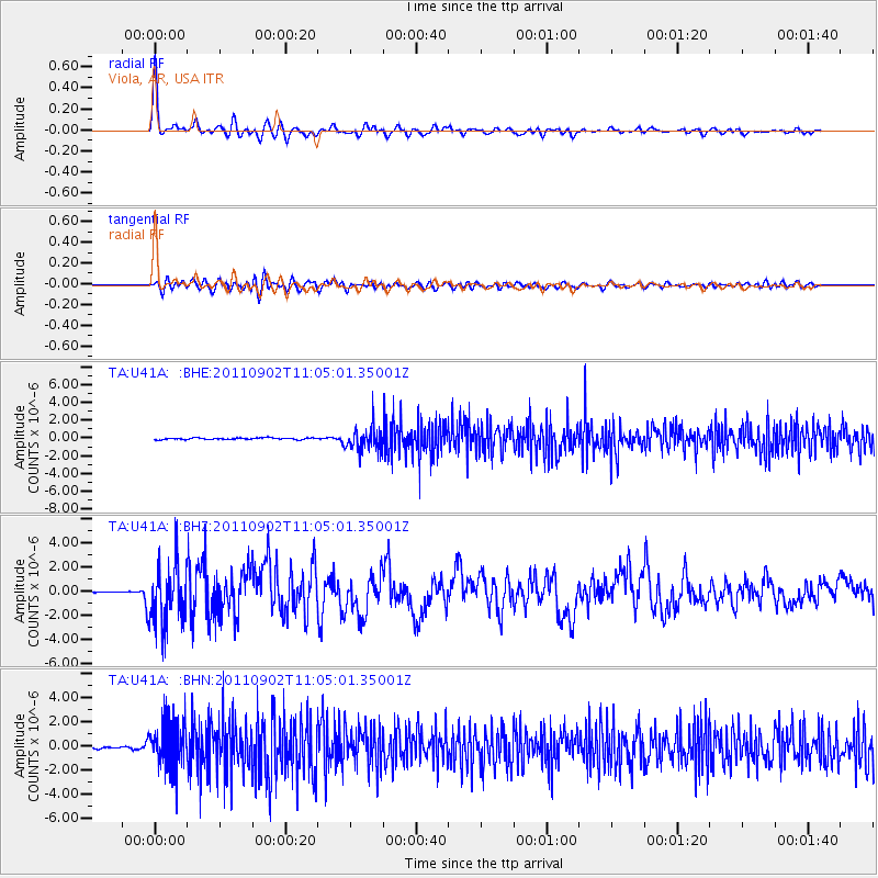
Earthquake location: Fox Islands, Aleutian Islands
Earthquake latitude/longitude: 52.2/-171.7
Earthquake time(UTC): 2011/09/02 (245) 10:55:53 GMT
Earthquake Depth: 32 km
Earthquake Magnitude: 6.5 MB, 6.9 MS, 6.8 MW, 6.8 MW
Earthquake Catalog/Contributor: WHDF/NEIC
Network: TA USArray Transportable Network (new EarthScope stations)
Station: U41A Viola, AR, USA
Lat/Lon: 36.34 N/91.92 W
Elevation: 300 m
Distance: 56.4 deg
Az: 72.494 deg
Baz: 313.324 deg
Ray Param: 0.06409422
Estimated Moho Depth: 39.5 km
Estimated Crust Vp/Vs: 1.99
Assumed Crust Vp: 6.53 km/s
Estimated Crust Vs: 3.286 km/s
Estimated Crust Poisson's Ratio: 0.33
Radial Match: 93.101944 %
Radial Bump: 400
Transverse Match: 77.83693 %
Transverse Bump: 400
SOD ConfigId: 414626
Insert Time: 2012-01-18 07:45:44.430 +0000
GWidth: 2.5
Max Bumps: 400
Tol: 0.001

Signal To Noise

ChannelStoNSTALTA
TA:U41A: :BHZ:20110902T11:05:01.35001Z32.4392242.4845754E-67.6591704E-8
TA:U41A: :BHN:20110902T11:05:01.35001Z29.3938181.9096583E-66.496803E-8
TA:U41A: :BHE:20110902T11:05:01.35001Z14.5656951.3395443E-69.19657E-8
Arrivals
Ps6.3 SECOND
PpPs17 SECOND
PsPs/PpSs24 SECOND