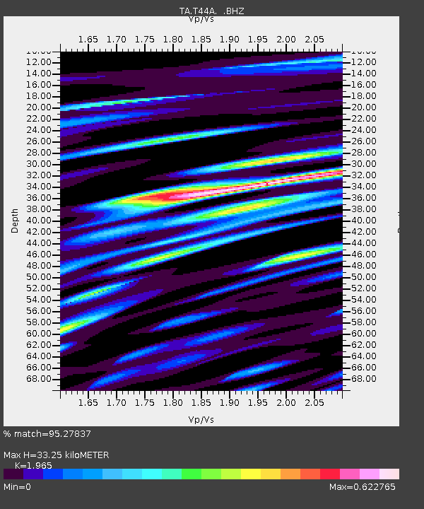
T44A Benton, MO, USA - Earthquake Result Viewer
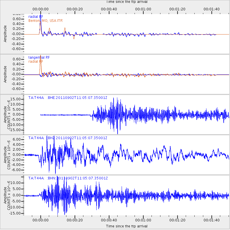
Earthquake location: Fox Islands, Aleutian Islands
Earthquake latitude/longitude: 52.2/-171.7
Earthquake time(UTC): 2011/09/02 (245) 10:55:53 GMT
Earthquake Depth: 32 km
Earthquake Magnitude: 6.5 MB, 6.9 MS, 6.8 MW, 6.8 MW
Earthquake Catalog/Contributor: WHDF/NEIC
Network: TA USArray Transportable Network (new EarthScope stations)
Station: T44A Benton, MO, USA
Lat/Lon: 37.09 N/89.59 W
Elevation: 133 m
Distance: 57.3 deg
Az: 70.314 deg
Baz: 313.519 deg
Ray Param: 0.063539214
Estimated Moho Depth: 33.25 km
Estimated Crust Vp/Vs: 1.97
Assumed Crust Vp: 6.444 km/s
Estimated Crust Vs: 3.279 km/s
Estimated Crust Poisson's Ratio: 0.33
Radial Match: 95.27837 %
Radial Bump: 400
Transverse Match: 81.716 %
Transverse Bump: 400
SOD ConfigId: 414626
Insert Time: 2012-01-18 07:45:52.943 +0000
GWidth: 2.5
Max Bumps: 400
Tol: 0.001

Signal To Noise

ChannelStoNSTALTA
TA:T44A: :BHZ:20110902T11:05:07.35001Z28.7181192.5716301E-68.95473E-8
TA:T44A: :BHN:20110902T11:05:07.35001Z19.9489043.1842005E-61.5961783E-7
TA:T44A: :BHE:20110902T11:05:07.35001Z20.9035452.8797217E-61.3776236E-7
Arrivals
Ps5.2 SECOND
PpPs15 SECOND
PsPs/PpSs20 SECOND