
M42A Sheffield, IL, USA - Earthquake Result Viewer
| ||||||||||||||||||
| ||||||||||||||||||
| ||||||||||||||||||
|
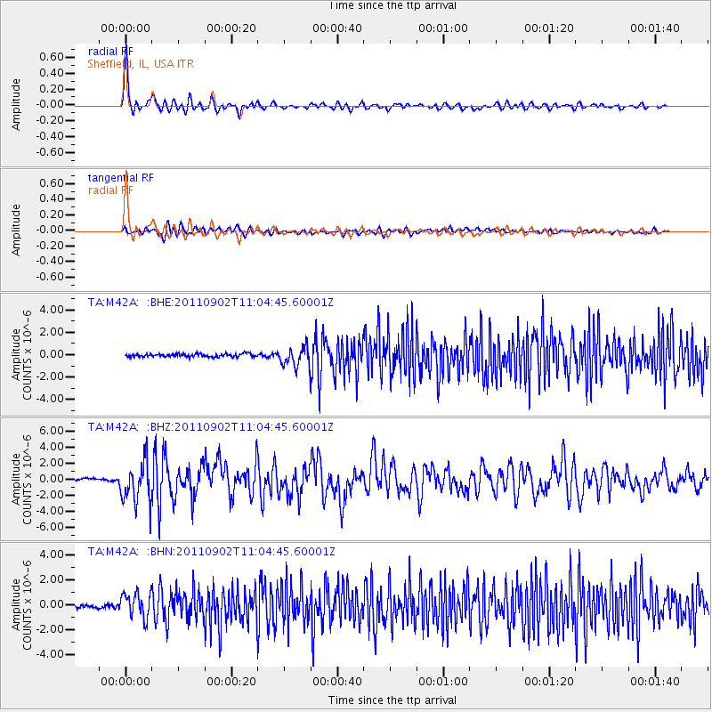
Signal To Noise
| Channel | StoN | STA | LTA |
| TA:M42A: :BHZ:20110902T11:04:45.60001Z | 19.254446 | 2.5842319E-6 | 1.3421482E-7 |
| TA:M42A: :BHN:20110902T11:04:45.60001Z | 6.88875 | 1.0033853E-6 | 1.4565563E-7 |
| TA:M42A: :BHE:20110902T11:04:45.60001Z | 6.594754 | 8.650936E-7 | 1.3117906E-7 |
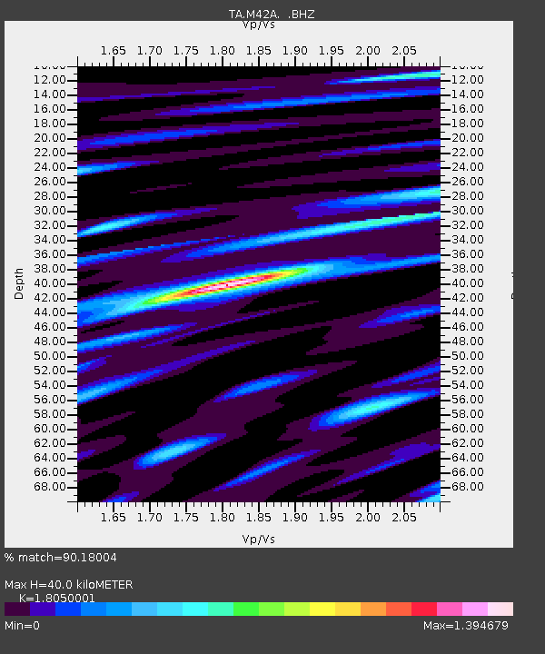
| Arrivals | |
| Ps | 5.2 SECOND |
| PpPs | 16 SECOND |
| PsPs/PpSs | 22 SECOND |

