V43A Jonesboro, AR, USA - Earthquake Result Viewer
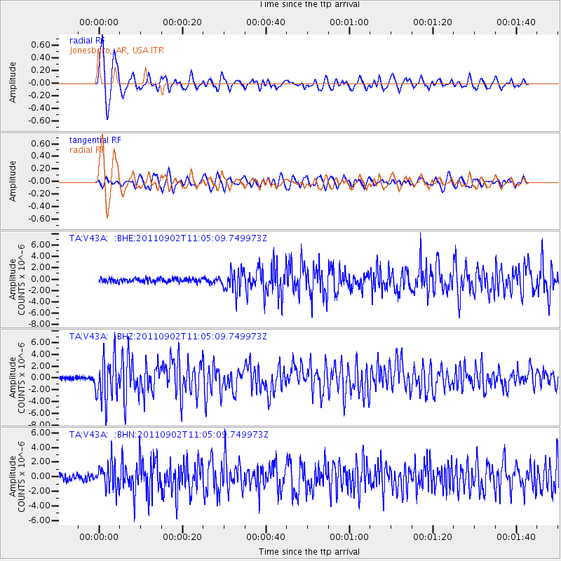
Earthquake location: Fox Islands, Aleutian Islands
Earthquake latitude/longitude: 52.2/-171.7
Earthquake time(UTC): 2011/09/02 (245) 10:55:53 GMT
Earthquake Depth: 32 km
Earthquake Magnitude: 6.5 MB, 6.9 MS, 6.8 MW, 6.8 MW
Earthquake Catalog/Contributor: WHDF/NEIC
Network: TA USArray Transportable Network (new EarthScope stations)
Station: V43A Jonesboro, AR, USA
Lat/Lon: 35.79 N/90.54 W
Elevation: 74 m
Distance: 57.6 deg
Az: 72.058 deg
Baz: 313.893 deg
Ray Param: 0.0633228
Estimated Moho Depth: 11.75 km
Estimated Crust Vp/Vs: 1.60
Assumed Crust Vp: 6.273 km/s
Estimated Crust Vs: 3.921 km/s
Estimated Crust Poisson's Ratio: 0.18
Radial Match: 85.89951 %
Radial Bump: 400
Transverse Match: 76.98358 %
Transverse Bump: 400
SOD ConfigId: 414626
Insert Time: 2012-01-18 07:46:33.983 +0000
GWidth: 2.5
Max Bumps: 400
Tol: 0.001

Signal To Noise

ChannelStoNSTALTA
TA:V43A: :BHZ:20110902T11:05:09.749973Z18.3050693.6013487E-61.967405E-7
TA:V43A: :BHN:20110902T11:05:09.749973Z4.5406671.6892516E-63.7202716E-7
TA:V43A: :BHE:20110902T11:05:09.749973Z5.7504551.8328867E-63.187377E-7
Arrivals
Ps1.2 SECOND
PpPs4.6 SECOND
PsPs/PpSs5.8 SECOND