
W42A Bald Knob, AR, USA - Earthquake Result Viewer
| ||||||||||||||||||
| ||||||||||||||||||
| ||||||||||||||||||
|
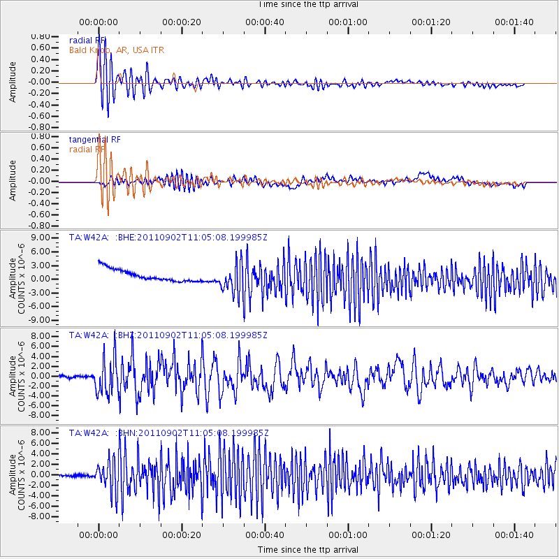
Signal To Noise
| Channel | StoN | STA | LTA |
| TA:W42A: :BHZ:20110902T11:05:08.199985Z | 18.20629 | 3.7294599E-6 | 2.0484461E-7 |
| TA:W42A: :BHN:20110902T11:05:08.199985Z | 12.407036 | 2.9518017E-6 | 2.3791351E-7 |
| TA:W42A: :BHE:20110902T11:05:08.199985Z | 2.6877487 | 3.42314E-6 | 1.2736086E-6 |
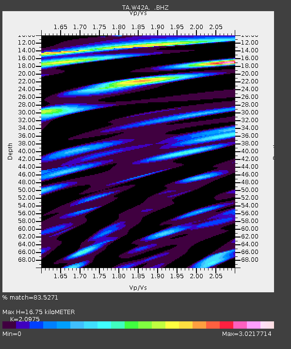
| Arrivals | |
| Ps | 3.0 SECOND |
| PpPs | 7.9 SECOND |
| PsPs/PpSs | 11 SECOND |

