R43A Red Bud, IL, USA - Earthquake Result Viewer
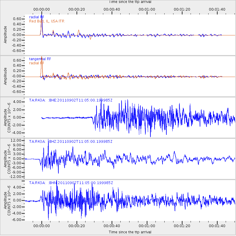
Earthquake location: Fox Islands, Aleutian Islands
Earthquake latitude/longitude: 52.2/-171.7
Earthquake time(UTC): 2011/09/02 (245) 10:55:53 GMT
Earthquake Depth: 32 km
Earthquake Magnitude: 6.5 MB, 6.9 MS, 6.8 MW, 6.8 MW
Earthquake Catalog/Contributor: WHDF/NEIC
Network: TA USArray Transportable Network (new EarthScope stations)
Station: R43A Red Bud, IL, USA
Lat/Lon: 38.28 N/89.93 W
Elevation: 186 m
Distance: 56.3 deg
Az: 69.5 deg
Baz: 312.865 deg
Ray Param: 0.06419771
Estimated Moho Depth: 40.25 km
Estimated Crust Vp/Vs: 2.04
Assumed Crust Vp: 6.444 km/s
Estimated Crust Vs: 3.159 km/s
Estimated Crust Poisson's Ratio: 0.34
Radial Match: 96.53331 %
Radial Bump: 400
Transverse Match: 87.052475 %
Transverse Bump: 400
SOD ConfigId: 414626
Insert Time: 2012-01-18 07:47:29.243 +0000
GWidth: 2.5
Max Bumps: 400
Tol: 0.001

Signal To Noise

ChannelStoNSTALTA
TA:R43A: :BHZ:20110902T11:05:00.199985Z41.8405274.0040327E-69.5697466E-8
TA:R43A: :BHN:20110902T11:05:00.199985Z24.2832641.7552045E-67.228042E-8
TA:R43A: :BHE:20110902T11:05:00.199985Z24.0644321.7112218E-67.111E-8
Arrivals
Ps6.8 SECOND
PpPs18 SECOND
PsPs/PpSs25 SECOND