G38A Ridgeland, WI, USA - Earthquake Result Viewer
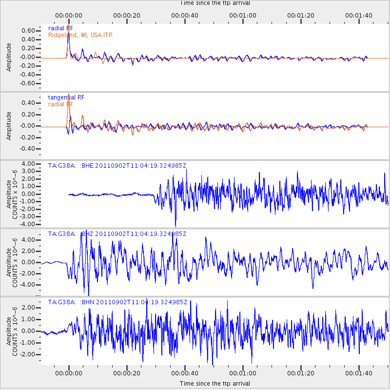
Earthquake location: Fox Islands, Aleutian Islands
Earthquake latitude/longitude: 52.2/-171.7
Earthquake time(UTC): 2011/09/02 (245) 10:55:53 GMT
Earthquake Depth: 32 km
Earthquake Magnitude: 6.5 MB, 6.9 MS, 6.8 MW, 6.8 MW
Earthquake Catalog/Contributor: WHDF/NEIC
Network: TA USArray Transportable Network (new EarthScope stations)
Station: G38A Ridgeland, WI, USA
Lat/Lon: 45.17 N/91.85 W
Elevation: 370 m
Distance: 50.7 deg
Az: 64.166 deg
Baz: 308.407 deg
Ray Param: 0.06782948
Estimated Moho Depth: 45.25 km
Estimated Crust Vp/Vs: 1.67
Assumed Crust Vp: 6.571 km/s
Estimated Crust Vs: 3.935 km/s
Estimated Crust Poisson's Ratio: 0.22
Radial Match: 90.166664 %
Radial Bump: 400
Transverse Match: 88.00307 %
Transverse Bump: 400
SOD ConfigId: 414626
Insert Time: 2012-01-18 07:48:36.548 +0000
GWidth: 2.5
Max Bumps: 400
Tol: 0.001

Signal To Noise

ChannelStoNSTALTA
TA:G38A: :BHZ:20110902T11:04:19.324985Z14.1261312.2769334E-61.6118592E-7
TA:G38A: :BHN:20110902T11:04:19.324985Z8.9011286.344383E-77.127617E-8
TA:G38A: :BHE:20110902T11:04:19.324985Z10.18617259.602264E-79.426764E-8
Arrivals
Ps4.9 SECOND
PpPs17 SECOND
PsPs/PpSs22 SECOND