YACT Amboy, WA, USA - Earthquake Result Viewer
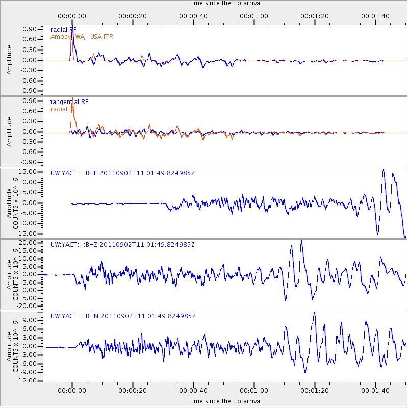
Earthquake location: Fox Islands, Aleutian Islands
Earthquake latitude/longitude: 52.2/-171.7
Earthquake time(UTC): 2011/09/02 (245) 10:55:53 GMT
Earthquake Depth: 32 km
Earthquake Magnitude: 6.5 MB, 6.9 MS, 6.8 MW, 6.8 MW
Earthquake Catalog/Contributor: WHDF/NEIC
Network: UW Pacific Northwest Regional Seismic Network
Station: YACT Amboy, WA, USA
Lat/Lon: 45.93 N/122.42 W
Elevation: 211 m
Distance: 32.4 deg
Az: 81.142 deg
Baz: 299.316 deg
Ray Param: 0.07863273
Estimated Moho Depth: 59.0 km
Estimated Crust Vp/Vs: 2.08
Assumed Crust Vp: 6.566 km/s
Estimated Crust Vs: 3.157 km/s
Estimated Crust Poisson's Ratio: 0.35
Radial Match: 89.922295 %
Radial Bump: 343
Transverse Match: 79.63384 %
Transverse Bump: 400
SOD ConfigId: 414626
Insert Time: 2012-01-18 07:52:37.640 +0000
GWidth: 2.5
Max Bumps: 400
Tol: 0.001

Signal To Noise

ChannelStoNSTALTA
UW:YACT: :BHZ:20110902T11:01:49.824985Z22.379893.749145E-61.6752294E-7
UW:YACT: :BHN:20110902T11:01:49.824985Z10.3241018.908427E-78.628768E-8
UW:YACT: :BHE:20110902T11:01:49.824985Z15.695821.7801901E-61.134181E-7
Arrivals
Ps10 SECOND
PpPs26 SECOND
PsPs/PpSs36 SECOND