LEBA Lebam, WA, USA - Earthquake Result Viewer
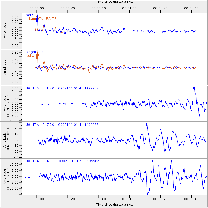
Earthquake location: Fox Islands, Aleutian Islands
Earthquake latitude/longitude: 52.2/-171.7
Earthquake time(UTC): 2011/09/02 (245) 10:55:53 GMT
Earthquake Depth: 32 km
Earthquake Magnitude: 6.5 MB, 6.9 MS, 6.8 MW, 6.8 MW
Earthquake Catalog/Contributor: WHDF/NEIC
Network: UW Pacific Northwest Regional Seismic Network
Station: LEBA Lebam, WA, USA
Lat/Lon: 46.55 N/123.56 W
Elevation: 73 m
Distance: 31.4 deg
Az: 80.848 deg
Baz: 298.243 deg
Ray Param: 0.07905393
Estimated Moho Depth: 47.75 km
Estimated Crust Vp/Vs: 1.62
Assumed Crust Vp: 6.566 km/s
Estimated Crust Vs: 4.053 km/s
Estimated Crust Poisson's Ratio: 0.19
Radial Match: 89.55611 %
Radial Bump: 400
Transverse Match: 77.34483 %
Transverse Bump: 400
SOD ConfigId: 414626
Insert Time: 2012-01-18 07:53:29.603 +0000
GWidth: 2.5
Max Bumps: 400
Tol: 0.001

Signal To Noise

ChannelStoNSTALTA
UW:LEBA: :BHZ:20110902T11:01:41.149998Z24.099214.000606E-61.6600569E-7
UW:LEBA: :BHN:20110902T11:01:41.149998Z8.9361711.4114952E-61.5795302E-7
UW:LEBA: :BHE:20110902T11:01:41.149998Z10.3207951.6827331E-61.6304297E-7
Arrivals
Ps4.9 SECOND
PpPs17 SECOND
PsPs/PpSs22 SECOND