You are here: Home > Network List > AZ - ANZA Regional Network Stations List
> Station SMER AZ.SMER > Earthquake Result Viewer
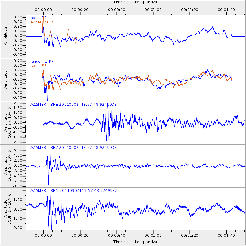
SMER AZ.SMER - Earthquake Result Viewer
*The percent match for this event was below the threshold and hence no stack was calculated.
| Earthquake location: |
Santiago Del Estero Prov., Arg. |
| Earthquake latitude/longitude: |
-28.4/-63.0 |
| Earthquake time(UTC): |
2011/09/02 (245) 13:47:09 GMT |
| Earthquake Depth: |
579 km |
| Earthquake Magnitude: |
6.4 MB, 6.7 MW, 6.7 MW |
| Earthquake Catalog/Contributor: |
WHDF/NEIC |
|
| Network: |
AZ ANZA Regional Network |
| Station: |
SMER AZ.SMER |
| Lat/Lon: |
33.46 N/117.17 W |
| Elevation: |
355 m |
|
| Distance: |
80.1 deg |
| Az: |
316.546 deg |
| Baz: |
133.548 deg |
| Ray Param: |
$rayparam |
*The percent match for this event was below the threshold and hence was not used in the summary stack. |
|
| Radial Match: |
57.623383 % |
| Radial Bump: |
400 |
| Transverse Match: |
71.81159 % |
| Transverse Bump: |
400 |
| SOD ConfigId: |
414626 |
| Insert Time: |
2012-01-18 08:28:06.186 +0000 |
| GWidth: |
2.5 |
| Max Bumps: |
400 |
| Tol: |
0.001 |
|
Signal To Noise
| Channel | StoN | STA | LTA |
| AZ:SMER: :BHZ:20110902T13:57:48.924993Z | 11.604925 | 2.3454863E-6 | 2.021113E-7 |
| AZ:SMER: :BHN:20110902T13:57:48.924993Z | 2.7667131 | 9.971272E-7 | 3.6040137E-7 |
| AZ:SMER: :BHE:20110902T13:57:48.924993Z | 3.22158 | 6.408078E-7 | 1.9891102E-7 |
| Arrivals |
| Ps | |
| PpPs | |
| PsPs/PpSs | |


