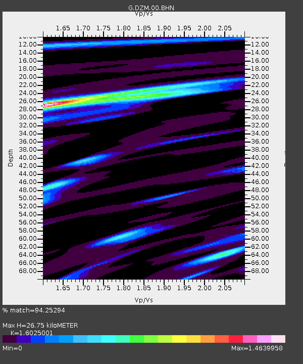
DZM Dzumac, New Caledonia - Earthquake Result Viewer
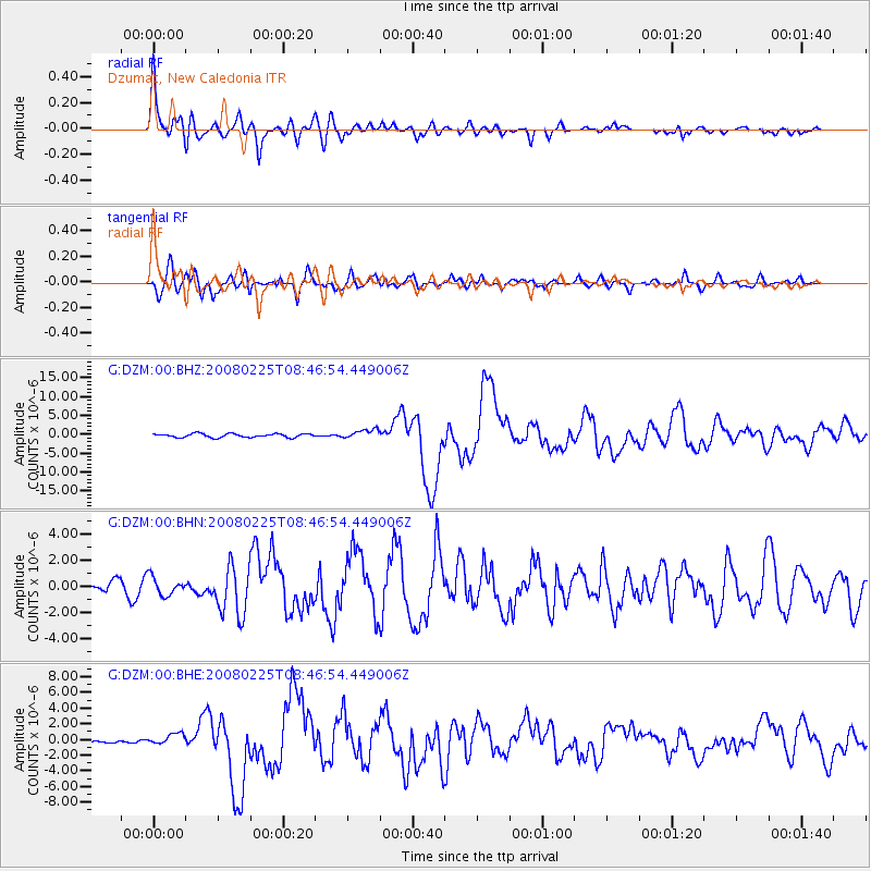
Earthquake location: Southern Sumatra, Indonesia
Earthquake latitude/longitude: -2.5/100.0
Earthquake time(UTC): 2008/02/25 (056) 08:36:33 GMT
Earthquake Depth: 25 km
Earthquake Magnitude: 6.4 MB, 7.3 MS, 7.0 MW, 6.9 MW
Earthquake Catalog/Contributor: WHDF/NEIC
Network: G GEOSCOPE
Station: DZM Dzumac, New Caledonia
Lat/Lon: 22.07 S/166.44 E
Elevation: 878 m
Distance: 67.3 deg
Az: 112.788 deg
Baz: 276.788 deg
Ray Param: 0.057019666
Estimated Moho Depth: 26.75 km
Estimated Crust Vp/Vs: 1.60
Assumed Crust Vp: 5.14 km/s
Estimated Crust Vs: 3.207 km/s
Estimated Crust Poisson's Ratio: 0.18
Radial Match: 94.25294 %
Radial Bump: 400
Transverse Match: 88.36433 %
Transverse Bump: 400
SOD ConfigId: 2564
Insert Time: 2010-02-26 22:17:24.068 +0000
GWidth: 2.5
Max Bumps: 400
Tol: 0.001

Signal To Noise

ChannelStoNSTALTA
G:DZM:00:BHN:20080225T08:46:54.449006Z1.31502627.080854E-75.384573E-7
G:DZM:00:BHE:20080225T08:46:54.449006Z1.89908657.5216207E-73.960652E-7
G:DZM:00:BHZ:20080225T08:46:54.449006Z2.415181.1822867E-64.895233E-7
Arrivals
Ps3.2 SECOND
PpPs13 SECOND
PsPs/PpSs16 SECOND