You are here: Home > Network List > TA - USArray Transportable Network (new EarthScope stations) Stations List
> Station G05D Wamic, OR, USA > Earthquake Result Viewer
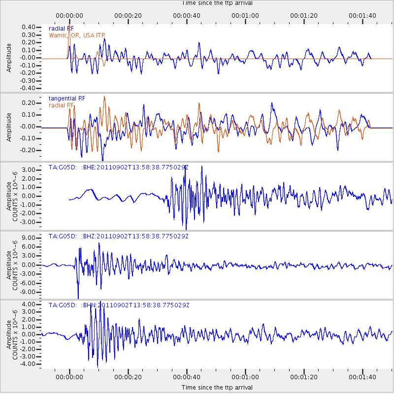
G05D Wamic, OR, USA - Earthquake Result Viewer
*The percent match for this event was below the threshold and hence no stack was calculated.
| Earthquake location: |
Santiago Del Estero Prov., Arg. |
| Earthquake latitude/longitude: |
-28.4/-63.0 |
| Earthquake time(UTC): |
2011/09/02 (245) 13:47:09 GMT |
| Earthquake Depth: |
579 km |
| Earthquake Magnitude: |
6.4 MB, 6.7 MW, 6.7 MW |
| Earthquake Catalog/Contributor: |
WHDF/NEIC |
|
| Network: |
TA USArray Transportable Network (new EarthScope stations) |
| Station: |
G05D Wamic, OR, USA |
| Lat/Lon: |
45.24 N/121.32 W |
| Elevation: |
592 m |
|
| Distance: |
90.4 deg |
| Az: |
323.056 deg |
| Baz: |
131.454 deg |
| Ray Param: |
$rayparam |
*The percent match for this event was below the threshold and hence was not used in the summary stack. |
|
| Radial Match: |
64.70232 % |
| Radial Bump: |
400 |
| Transverse Match: |
64.31161 % |
| Transverse Bump: |
400 |
| SOD ConfigId: |
414626 |
| Insert Time: |
2012-01-18 08:48:12.427 +0000 |
| GWidth: |
2.5 |
| Max Bumps: |
400 |
| Tol: |
0.001 |
|
Signal To Noise
| Channel | StoN | STA | LTA |
| TA:G05D: :BHZ:20110902T13:58:38.775029Z | 8.768987 | 2.9470875E-6 | 3.3608075E-7 |
| TA:G05D: :BHN:20110902T13:58:38.775029Z | 1.4851205 | 4.0582066E-7 | 2.7325774E-7 |
| TA:G05D: :BHE:20110902T13:58:38.775029Z | 1.7478625 | 6.2728583E-7 | 3.588874E-7 |
| Arrivals |
| Ps | |
| PpPs | |
| PsPs/PpSs | |


