You are here: Home > Network List > TA - USArray Transportable Network (new EarthScope stations) Stations List
> Station 933A Laredo, TX, USA > Earthquake Result Viewer
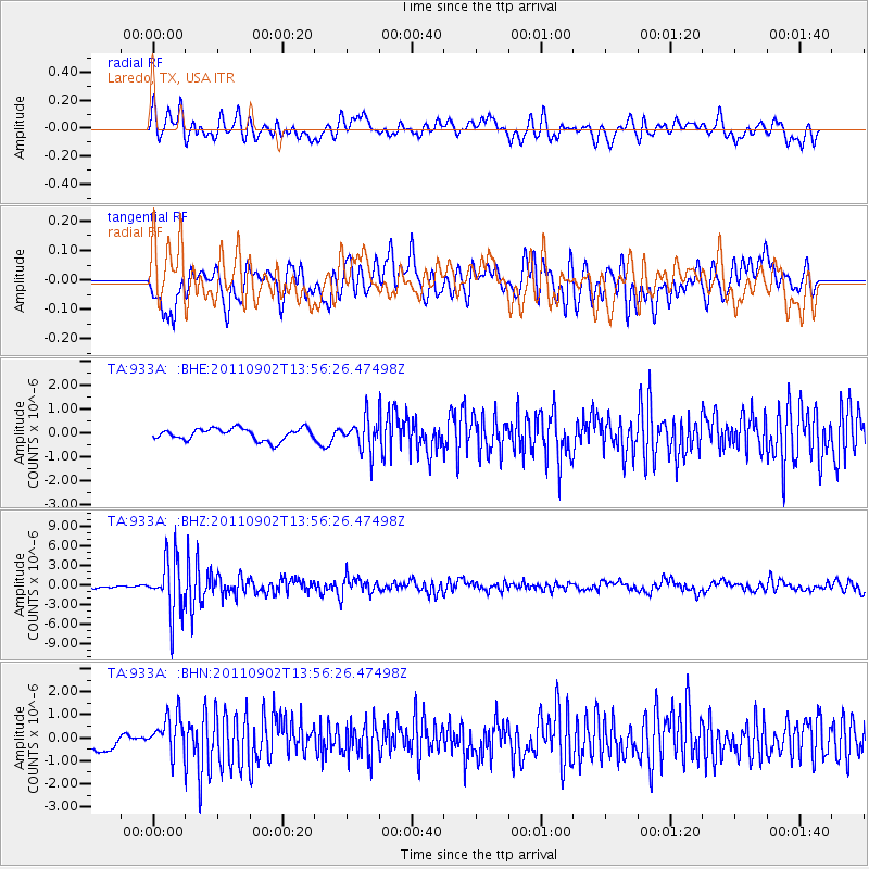
933A Laredo, TX, USA - Earthquake Result Viewer
*The percent match for this event was below the threshold and hence no stack was calculated.
| Earthquake location: |
Santiago Del Estero Prov., Arg. |
| Earthquake latitude/longitude: |
-28.4/-63.0 |
| Earthquake time(UTC): |
2011/09/02 (245) 13:47:09 GMT |
| Earthquake Depth: |
579 km |
| Earthquake Magnitude: |
6.4 MB, 6.7 MW, 6.7 MW |
| Earthquake Catalog/Contributor: |
WHDF/NEIC |
|
| Network: |
TA USArray Transportable Network (new EarthScope stations) |
| Station: |
933A Laredo, TX, USA |
| Lat/Lon: |
27.61 N/99.27 W |
| Elevation: |
214 m |
|
| Distance: |
65.6 deg |
| Az: |
324.838 deg |
| Baz: |
145.127 deg |
| Ray Param: |
$rayparam |
*The percent match for this event was below the threshold and hence was not used in the summary stack. |
|
| Radial Match: |
71.653595 % |
| Radial Bump: |
400 |
| Transverse Match: |
70.14396 % |
| Transverse Bump: |
400 |
| SOD ConfigId: |
414626 |
| Insert Time: |
2012-01-18 08:52:28.103 +0000 |
| GWidth: |
2.5 |
| Max Bumps: |
400 |
| Tol: |
0.001 |
|
Signal To Noise
| Channel | StoN | STA | LTA |
| TA:933A: :BHZ:20110902T13:56:26.47498Z | 15.256923 | 4.270758E-6 | 2.799226E-7 |
| TA:933A: :BHN:20110902T13:56:26.47498Z | 2.3945498 | 8.3579243E-7 | 3.4903948E-7 |
| TA:933A: :BHE:20110902T13:56:26.47498Z | 2.5918496 | 6.4384847E-7 | 2.4841273E-7 |
| Arrivals |
| Ps | |
| PpPs | |
| PsPs/PpSs | |


