You are here: Home > Network List > CN - Canadian National Seismograph Network Stations List
> Station INK INUVIK, NT > Earthquake Result Viewer
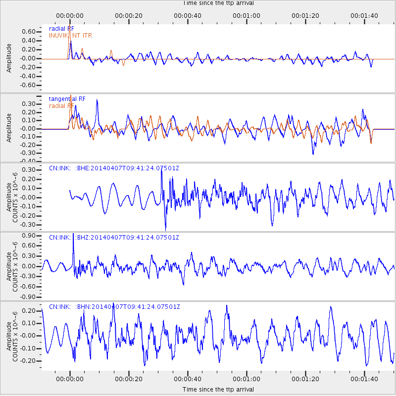
INK INUVIK, NT - Earthquake Result Viewer
*The percent match for this event was below the threshold and hence no stack was calculated.
| Earthquake location: |
Kuril Islands |
| Earthquake latitude/longitude: |
50.4/156.3 |
| Earthquake time(UTC): |
2014/04/07 (097) 09:34:49 GMT |
| Earthquake Depth: |
85 km |
| Earthquake Magnitude: |
5.2 MW |
| Earthquake Catalog/Contributor: |
ISC/ISC |
|
| Network: |
CN Canadian National Seismograph Network |
| Station: |
INK INUVIK, NT |
| Lat/Lon: |
68.31 N/133.53 W |
| Elevation: |
44 m |
|
| Distance: |
37.4 deg |
| Az: |
35.146 deg |
| Baz: |
277.947 deg |
| Ray Param: |
$rayparam |
*The percent match for this event was below the threshold and hence was not used in the summary stack. |
|
| Radial Match: |
58.950058 % |
| Radial Bump: |
400 |
| Transverse Match: |
70.23469 % |
| Transverse Bump: |
400 |
| SOD ConfigId: |
3390531 |
| Insert Time: |
2019-04-11 04:58:40.013 +0000 |
| GWidth: |
2.5 |
| Max Bumps: |
400 |
| Tol: |
0.001 |
|
Signal To Noise
| Channel | StoN | STA | LTA |
| CN:INK: :BHZ:20140407T09:41:24.07501Z | 2.7759488 | 2.3454021E-7 | 8.449011E-8 |
| CN:INK: :BHN:20140407T09:41:24.07501Z | 1.1176486 | 9.842311E-8 | 8.8062656E-8 |
| CN:INK: :BHE:20140407T09:41:24.07501Z | 1.740301 | 1.3490525E-7 | 7.7518344E-8 |
| Arrivals |
| Ps | |
| PpPs | |
| PsPs/PpSs | |


