You are here: Home > Network List > TA - USArray Transportable Network (new EarthScope stations) Stations List
> Station J34A George, IA, USA > Earthquake Result Viewer
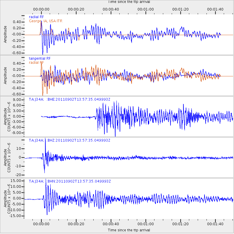
J34A George, IA, USA - Earthquake Result Viewer
*The percent match for this event was below the threshold and hence no stack was calculated.
| Earthquake location: |
Santiago Del Estero Prov., Arg. |
| Earthquake latitude/longitude: |
-28.4/-63.0 |
| Earthquake time(UTC): |
2011/09/02 (245) 13:47:09 GMT |
| Earthquake Depth: |
579 km |
| Earthquake Magnitude: |
6.4 MB, 6.7 MW, 6.7 MW |
| Earthquake Catalog/Contributor: |
WHDF/NEIC |
|
| Network: |
TA USArray Transportable Network (new EarthScope stations) |
| Station: |
J34A George, IA, USA |
| Lat/Lon: |
43.28 N/95.96 W |
| Elevation: |
432 m |
|
| Distance: |
77.5 deg |
| Az: |
336.007 deg |
| Baz: |
150.622 deg |
| Ray Param: |
$rayparam |
*The percent match for this event was below the threshold and hence was not used in the summary stack. |
|
| Radial Match: |
79.752464 % |
| Radial Bump: |
400 |
| Transverse Match: |
87.27611 % |
| Transverse Bump: |
400 |
| SOD ConfigId: |
414626 |
| Insert Time: |
2012-01-18 09:03:07.319 +0000 |
| GWidth: |
2.5 |
| Max Bumps: |
400 |
| Tol: |
0.001 |
|
Signal To Noise
| Channel | StoN | STA | LTA |
| TA:J34A: :BHZ:20110902T13:57:35.049993Z | 17.993048 | 6.136453E-6 | 3.410458E-7 |
| TA:J34A: :BHN:20110902T13:57:35.049993Z | 12.743678 | 5.9722065E-6 | 4.6864074E-7 |
| TA:J34A: :BHE:20110902T13:57:35.049993Z | 11.002052 | 2.6520472E-6 | 2.4105023E-7 |
| Arrivals |
| Ps | |
| PpPs | |
| PsPs/PpSs | |


