You are here: Home > Network List > NM - Cooperative New Madrid Seismic Network Stations List
> Station HDAR2 I40 Weigh Station,West Memphis,AR > Earthquake Result Viewer
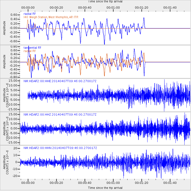
HDAR2 I40 Weigh Station,West Memphis,AR - Earthquake Result Viewer
*The percent match for this event was below the threshold and hence no stack was calculated.
| Earthquake location: |
Kuril Islands |
| Earthquake latitude/longitude: |
50.4/156.3 |
| Earthquake time(UTC): |
2014/04/07 (097) 09:34:49 GMT |
| Earthquake Depth: |
85 km |
| Earthquake Magnitude: |
5.2 MW |
| Earthquake Catalog/Contributor: |
ISC/ISC |
|
| Network: |
NM Cooperative New Madrid Seismic Network |
| Station: |
HDAR2 I40 Weigh Station,West Memphis,AR |
| Lat/Lon: |
35.15 N/90.09 W |
| Elevation: |
100 m |
|
| Distance: |
76.6 deg |
| Az: |
50.531 deg |
| Baz: |
322.944 deg |
| Ray Param: |
$rayparam |
*The percent match for this event was below the threshold and hence was not used in the summary stack. |
|
| Radial Match: |
60.269093 % |
| Radial Bump: |
400 |
| Transverse Match: |
58.452152 % |
| Transverse Bump: |
400 |
| SOD ConfigId: |
3390531 |
| Insert Time: |
2019-04-11 05:01:05.228 +0000 |
| GWidth: |
2.5 |
| Max Bumps: |
400 |
| Tol: |
0.001 |
|
Signal To Noise
| Channel | StoN | STA | LTA |
| NM:HDAR2:00:HHZ:20140407T09:46:00.270017Z | 1.0638057 | 1.9919316E-6 | 1.8724581E-6 |
| NM:HDAR2:00:HHN:20140407T09:46:00.270017Z | 1.2100563 | 2.8914599E-6 | 2.3895252E-6 |
| NM:HDAR2:00:HHE:20140407T09:46:00.270017Z | 0.96076465 | 2.420624E-6 | 2.5194768E-6 |
| Arrivals |
| Ps | |
| PpPs | |
| PsPs/PpSs | |


