You are here: Home > Network List > TA - USArray Transportable Network (new EarthScope stations) Stations List
> Station 348A Jackson, AL, USA > Earthquake Result Viewer
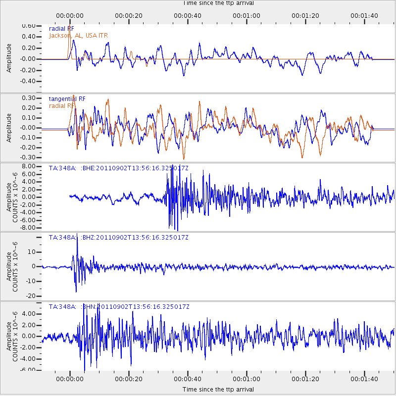
348A Jackson, AL, USA - Earthquake Result Viewer
*The percent match for this event was below the threshold and hence no stack was calculated.
| Earthquake location: |
Santiago Del Estero Prov., Arg. |
| Earthquake latitude/longitude: |
-28.4/-63.0 |
| Earthquake time(UTC): |
2011/09/02 (245) 13:47:09 GMT |
| Earthquake Depth: |
579 km |
| Earthquake Magnitude: |
6.4 MB, 6.7 MW, 6.7 MW |
| Earthquake Catalog/Contributor: |
WHDF/NEIC |
|
| Network: |
TA USArray Transportable Network (new EarthScope stations) |
| Station: |
348A Jackson, AL, USA |
| Lat/Lon: |
31.41 N/87.90 W |
| Elevation: |
57 m |
|
| Distance: |
64.0 deg |
| Az: |
336.42 deg |
| Baz: |
155.657 deg |
| Ray Param: |
$rayparam |
*The percent match for this event was below the threshold and hence was not used in the summary stack. |
|
| Radial Match: |
59.771034 % |
| Radial Bump: |
400 |
| Transverse Match: |
64.00477 % |
| Transverse Bump: |
400 |
| SOD ConfigId: |
414626 |
| Insert Time: |
2012-01-18 09:18:48.865 +0000 |
| GWidth: |
2.5 |
| Max Bumps: |
400 |
| Tol: |
0.001 |
|
Signal To Noise
| Channel | StoN | STA | LTA |
| TA:348A: :BHZ:20110902T13:56:16.325017Z | 13.963307 | 6.744177E-6 | 4.829928E-7 |
| TA:348A: :BHN:20110902T13:56:16.325017Z | 2.316425 | 1.68433E-6 | 7.2712476E-7 |
| TA:348A: :BHE:20110902T13:56:16.325017Z | 4.3232183 | 2.764807E-6 | 6.395252E-7 |
| Arrivals |
| Ps | |
| PpPs | |
| PsPs/PpSs | |


